Description:
Collins, Greenville : Chart of Milford Haven, from Great Britain's Coasting Pilot, ca.1760. Copper engraved chart. Map size approx 560mm x 440mm. Wide margins, hand coloured, good impression on heavy paper, showing the Welsh coast at Milford Haven. Compass rose, rhumb lines, scale. Cartouche with cherub, dedicated to Sir Hugh Owen. Light water stain to top margin just touching printed area, otherwise a very good, bright and attractive chart.
Ducatuum Livoniae et Curlandiae nova Tabula descripta divisa, et edita per F. de Wit Cum Privil. Potent. D. Ordin. Belgii Foederati by Wit, F.de - 1670
by Wit, F.de
Similar copies are shown below.
Similar copies are shown to the right.

Ducatuum Livoniae et Curlandiae nova Tabula descripta divisa, et edita per F. de Wit Cum Privil. Potent. D. Ordin. Belgii Foederati
by Wit, F.de
- Used
- good
Amsterdam: F. de Wit, 1670. Book. Good. No Binding. No date Circa 1670. Map of the Baltic region.The map has a dark stain across the lower third. The color on the logo is still fairly bright however most of the wash is faded out. 25 1/8th X 21 9/16s inches.
-
Bookseller
Mark Henderson
 (US)
(US)
- Book Condition Used - Good
- Publisher F. de Wit
- Place of Publication Amsterdam
- Date Published 1670
- Keywords ANTIQUE MAP
We have 1 copies available starting at A$155.00.

Sea Chart of Milford Haven,
by Greenville Collins
- Used
- very good
- Condition
- Used - Very Good
- Edition
- Original 18th Century, Hand Coloured Sea Chart
- Quantity Available
- 1
- Seller
-
Plymouth, Devon, United Kingdom
- Item Price
-
A$194.00
Show Details
Item Price
A$194.00

Isthmus of Panama.: Original Antique Map.
by John Tallis & Rapkin
- Used
- first
- Condition
- Used
- Edition
- 1st Edition
- Quantity Available
- 1
- Seller
-
Plymouth, Devon, United Kingdom
- Item Price
-
A$155.20
Show Details
Description:
Tallis, John: Isthmus of Panama. London. [ca.1851]. From the Montgomery Martin Illustrated Atlas. Map engraved by Rapkin. Size approx 360 x 260mm. Original steel engraved map with original outline hand colouring. 2 vignettes include Gold seekers on their way over the Cordilleras and The Fort at Chagres. It also shows in red lines the proposed Canal and Rail communications routes. Decorative Border. Single page unfolded map in excellent, clean condition. Associated text page of the Montgomery Martin Atlas included.
Item Price
A$155.20

More Photos
Old Decorative Maps and Charts
by Humphreys, Arthur L.
- Used
- very good
- Hardcover
- first
- Condition
- Used - Very Good
- Jacket Condition
- No Jacket
- Edition
- First Edition
- Binding
- Hardcover
- Quantity Available
- 1
- Seller
-
Sumner, Iowa, United States
- Item Price
-
A$147.30
Show Details
Description:
London: London: Halton & Truscott Smith, LTD>. Limited Edition of 1500 copies of which this is number No. 906---Clean, no marks, pages pristine. 79 maps dated 1482-1776 from engravings in the MacPherson Collection. Top Edge Gilt--No DJ Covers rubbed and very slight lean to spine----interior in excellent condition. . Very Good. Hardcover. First Edition. 1926.
Item Price
A$147.30

Maps and Mapmakers of the Aegean
by Sphyroeras, Vasilis Avramea, Anna Ashdrahas, Spyros
- Used
- as new
- Hardcover
- first
- Condition
- As New
- Jacket Condition
- as new
- Edition
- First English language edition
- Binding
- Hardcover
- Quantity Available
- 1
- Seller
-
Thessaloniki, Greece
- Item Price
-
A$166.22
Show Details
Description:
Athens: Olkos, 1985. First English language edition. Hardcover. As New/as new. As new hardcover with DJ. 1st english ed. 263pages, 29X21,8cm.Translated by G. Cox, J. Solman. The charting of the Aegean Sea, or the Greek Archipelago, from the 15th up to the 19th century. Map Index; General Index. 166 color and black & white maps.
Item Price
A$166.22
More Photos
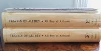
Travels of Ali Bey In Morocco, Tripoli, Cyprus, Egypt, Arabia, Syria, and Turkey. Volume One: Between the Years 1803 and 1807
by Ali Bey
- Used
- Fine
- Hardcover
- first
- Condition
- Used - Fine
- Jacket Condition
- Fine
- Edition
- 1st Edition (Folios Archive Library)
- Binding
- Hardcover
- ISBN 10 / ISBN 13
- 9781873938393 / 187393839X
- Quantity Available
- 1
- Seller
-
Port Fairy, Victoria, Australia
- Item Price
-
A$150.00
Show Details
Description:
Part of a Two volumes set. See Volume Two. Numerous B/W pictures, drawings, maps in separate folders. Introduction by Robin Bidwell.
Item Price
A$150.00

Amerique Septrionale [ Original Map From The Atlas Universal Illustre, By Levasseur, V. / Laguillermie]
by Levasseur, V. / Laguillermie
- Used
- Condition
- Used - Very Good +
- Edition
- Original Antique Map
- Binding
- Unknown
- Quantity Available
- 1
- Seller
-
Pasadena, California, United States
- Item Price
-
A$209.32
Show Details
Description:
Paris Circa 1840: A. Combette, 1840. Original Antique Map . Single Sheet. Very Good +. 21" x 14 1/4. Large Color Views By Raimond Bonheur. Original Decorative Map 21" X 14 1/4" Of North America Showing The United States As Claiming Much Of British Colombia, With The West Coast Of The Usa Continuing Well Into Present-Day Canada; Texas As A Republic; Guatemala Encompassing All Of Central America South Of Chiapas And Belize And North Of Panama. Large Panels At Sides With Detailed, Attractive And Well Colored Views Of People, Wildlife, Vegetation, High Mountains, Etc.Colors Very Bright And Well-Placed.
Item Price
A$209.32
![Russia in Europe [map]](https://d3525k1ryd2155.cloudfront.net/h/148/109/856109148.0.m.jpg)
More Photos
Russia in Europe [map]
by Stackhouse, Thomas
- Used
- Fine
- Condition
- Used - Fine
- Binding
- Unknown
- Quantity Available
- 1
- Seller
-
Lansdowne, Pennsylvania, United States
- Item Price
-
A$240.33
Show Details
Description:
London: T. Stackhouse, 1783. Map. Fine. Matted hand-colored copper engraving. Image size: 14.5 x 15.25 inches. Mat size: 22.75 x 23.75 inches. A beautiful example of this map of Eastern Europe showing the jurisdictions (as titled on the map) of Moscow, Woronesk, Bielgorod, Kiow, Smolensk, Novogorod, Nisi Nowogorod, Penzinskoi, Alatyrskoi, Galicoskoi, Chlynowskoi, Solkamskoi, Kaygorodskoi, Soli Wyczegokkoi, Jarenskoi, Peczora, Mezeskoi, Archangel, Carelia, the Kingdom of Kazan, and Russian Lapland, as well as parts of Poland, Ukrain, Livonia, Lithuania, Finland, and Siberia. In Fine Condition: clean and bright.
Item Price
A$240.33

More Photos
Africa, Drawn and Engraved from the best Maps and Charts
by Kitchin, T. Sculp (Thomas Kitchen)
- Used
- good
- Condition
- Used - Good
- Binding
- Unknown
- Quantity Available
- 1
- Seller
-
Datil, New Mexico, United States
- Item Price
-
A$155.05
Show Details
Description:
London: Harvey's Naval History Original antique map of 18th century Africa. Good condition. Size 34x37cm. Engraved for Harvey's Naval History, published in the early 1780s. This map also had been published in Daniel Fenning's "A New System of Geography" (1770s). The map has moderate foxing, closed tears along some of the folds, and chips & loss in the margins.. Good. Maps.
Item Price
A$155.05

GEZICHT VAN DEN BERG ARARAT VAN DEN KANT DER DREI KERKEN (Ansicht des Berges Ararat mit den drei Kirchen - View of Mount Ararat with the Three Churches)
by MOUNT ARARAT - Kupferstich - Original Antique Etching
- Used
- very good
- Condition
- Used - Very Good
- Binding
- Unknown
- Quantity Available
- 1
- Seller
-
Tel-Aviv, Israel
- Item Price
-
A$232.58
Show Details
Description:
1727. No Binding. Very Good. ORIGINAL-KUPFERSTICH ( holländische Ausgabe) von 1727 . Ansicht nach der Beschreibung von de Tournefort. 44 x 27,5. Gesamtansicht beider Gipfel. Frisches festes Papier. - ORIGINAL COPPER ETCHING , depicting MOUNT ARARAT - view following the description of Tournefort. Strong and fresh paper quality. -
Item Price
A$232.58

The Cossacks: A Tale of the Caucasus in the Year 1852. UKRAINIA
by Tolstoi, Count Lyof N.
- Used
- Hardcover
- first
- Condition
- Used - Good-
- Jacket Condition
- No DJ Included
- Edition
- First English Edition
- Binding
- Hardcover
- Quantity Available
- 1
- Seller
-
Salem, Oregon, United States
- Item Price
-
A$224.82A$134.89Save A$58.00!
Show Details
Description:
UKRAINIA Tolstoi, Count Lyof N.: The Cossacks: A Tale of the Caucasus in the Year 1852. First English Edition, 1888 Walter Scott, 24 Warwick Lane, Paternoster Row, London. Translated from the Russian by Nathan Haskell Dole. Summary: A novel of the Caucasian War 1817-1864. Used. Good- Condition/ No DJ. Blue Boards gold titling and ornamentation. Imperial Russian crest stamped in gilt at center front. A solid copy. Light foxing to endpapers. Toning. Fabric at top of spine missing. RARE/SCARCE.
Item Price
A$224.82A$134.89
Save A$58.00
!

Ducatuum Livoniae et Curlandiae nova Tabula descripta divisa, et edita per F. de Wit Cum Privil. Potent. D. Ordin. Belgii Foederati
by Wit, F.de
- Used
- good
- Condition
- Used - Good
- Quantity Available
- 1
- Seller
-
Olathe, Kansas, United States
- Item Price
-
A$155.00
Show Details
Description:
Amsterdam: F. de Wit, 1670. Book. Good. No Binding. No date Circa 1670. Map of the Baltic region.The map has a dark stain across the lower third. The color on the logo is still fairly bright however most of the wash is faded out. 25 1/8th X 21 9/16s inches.
Item Price
A$155.00

More Photos
The Sky and the Forest
by Forester, C.S
- Used
- very good
- Hardcover
- first
- Condition
- Used - Very Good
- Jacket Condition
- Very Good
- Edition
- First Edition
- Binding
- Hardcover
- Quantity Available
- 1
- Seller
-
Salem, Oregon, United States
- Item Price
-
A$54.10A$32.45Save A$13.96!
Show Details
Description:
C.S. Forester: The Sky and the Forest. Little, Brown and Company, Boston. Stated First Edition First Printing Thus August, 1948. Cover price $2.75. Used. VG BOOK/VG UNCLIPPED DUST JACKET. A story of a central Africa. By C.S. Forester, author of the Admiral Hornblower series.
Item Price
A$54.10A$32.45
Save A$13.96
!
![Alaska and Klondike Region; [With inset of Klondike Region on the Upper Yukon detail] [From an...](https://d3525k1ryd2155.cloudfront.net/h/062/537/1339537062.0.m.jpg)
Alaska and Klondike Region; [With inset of Klondike Region on the Upper Yukon detail] [From an atlas, "Gazetteer of Alaska and Yukon Region " pp. 105 and 106]
by Miller, J. Martin
- Used
- very good
- Condition
- Used - Very Good
- Edition
- Unknown
- Quantity Available
- 1
- Seller
-
Sebastopol, California, United States
- Item Price
-
A$60.47
Show Details
Description:
Chicago: J. Martin Miller, 1899. Unknown. Map. Very Good. [Map copyright 1899, printing date of Atlas later] [19.875x15.125in]; Colored map of Alaska with steamer routes from Portland and Seattle, insets of the Klondike Region on the Upper Yukon and Western portion of Aleutian Islands; On verso index of places and names with two large black and white images; Age toning to all edges, water stain marks on bottom, slight printing offset of colors, small chips and closed tears to lower edge;.
Item Price
A$60.47

Zemepis Sveta - Monsunova Asie
by De La Blache, P. Vidal; Gallois, L
- Used
- Hardcover
- Condition
- Used - Very Good Condition
- Jacket Condition
- No Dust Jacket
- Binding
- Hardcover
- Quantity Available
- 1
- Seller
-
Oak Point, Texas, United States
- Item Price
-
A$93.03
Show Details
Description:
Aventinum, Prague, Czechoslovakia, 1931. Hardcover. Very Good Condition/No Dust Jacket. Text entirely in Czech. Geography book on Asia with numerous photographs and maps. 1930 edition also available. Size: 4mo - over 9 3/4" - 12" tall. 400 pp. Pages are yellowed, but are tight and clean. Moderate shelfwear along the spine. Corners are lightly bumped. Quantity Available: 1. Shipped Weight: 3-5 pounds. Category: Travel & Places; Non-English Language::Czech; Pictures of this item not already displayed here available upon request. Inventory No: 001228. . Additional shipping charges may apply.
Item Price
A$93.03

Zemepis Sveta - Monsunova Asie
by De La Blache, P. Vidal; Gallois, L
- Used
- Hardcover
- Condition
- Used - Very Good Condition
- Jacket Condition
- No Dust Jacket
- Binding
- Hardcover
- Quantity Available
- 1
- Seller
-
Oak Point, Texas, United States
- Item Price
-
A$93.03
Show Details
Description:
Aventinum, Prague, Czechoslovakia, 1930. Hardcover. Very Good Condition/No Dust Jacket. Text entirely in Czech. Geography book on Asia with numerous photographs and maps. 1931 edition also available. Size: 4mo - over 9 3/4" - 12" tall. 400 pp. Pages are yellowed, but are tight and clean. Moderate shelfwear along the spine. Corners are lightly bumped. Quantity Available: 1. Shipped Weight: 3-5 pounds. Category: Travel & Places; Non-English Language::Czech; Pictures of this item not already displayed here available upon request. Inventory No: 001227. . Additional shipping charges may apply.
Item Price
A$93.03

North America from the Best Authorities, Russell, ca.1800
by Russell
- Used
- Condition
- Used
- Quantity Available
- 1
- Seller
-
Plymouth, Devon, United Kingdom
- Item Price
-
A$38.80
Show Details
Description:
Russell, J. : A General Map of North America from the Best Authorities. Nd but ca.1800. From "A New Geographical, Historical and Commercial Grammar and Present State of Several Kingdoms of the World." Copper engraving. Size approx 200 x 230mm. Two neat folds. Some age colouring to edges, otherwise very clean and bright.
Item Price
A$38.80

Asia from the Best Authorities, Russell, ca.1800
by Russell
- Used
- Condition
- Used
- Quantity Available
- 1
- Seller
-
Plymouth, Devon, United Kingdom
- Item Price
-
A$38.80
Show Details
Description:
Russell, J. : Asia from the Best Authorities. Nd but ca.1800. From "A New Geographical, Historical and Commercial Grammar and Present State of Several Kingdoms of the World". Copper engraving. Size approx 200 x 230mm. Two neat folds. Some age colouring to edges, otherwise clean and bright. Includes Arabia, India, Borneo, Japan, China and eastern Russia.
Item Price
A$38.80
![MAP OF UTAH [Territory]](https://d3525k1ryd2155.cloudfront.net/h/836/461/1485461836.0.m.jpg)
More Photos
MAP OF UTAH [Territory]
- Used
- Condition
- Used - Very Good-
- Edition
- Original
- Quantity Available
- 1
- Seller
-
Williamsburg, Virginia, United States
- Item Price
-
A$100.78
Show Details
Description:
New York, Richmond, Chicago, & Toledo: H. H. Hardesty, 1885. Original color lithographed map printed by Rand, McNally & Company, Engravers and published in HARDESTY'S HISTORICAL AND GEOGRAPHICAL ENCYCLOPEDIA: SPECIAL VIRGINIA EDITION. 19 3/8 inches by 13 1/4 inches on a 21" X 14 1/2" sheet. The map depicts the Territory of Utah in its final form--large areas had been removed and ceded to Nevada, Colorado, Wyoming, and Nebraska since Utah became a U. S. Territory in 1850. The issue of polygamy prevented statehood until it was finally granted in 1896. This map features railroads and topography and uses color to set off counties from each other. Unlike most atlas maps of the period, this map identifies most small towns. The map is guaranteed to be moe than 135 years old. The map is in about very good condition: generally clean and bright, with slight toning of paper and one faint water stain near the center-left edge of the map.. Original. Single Sheet. Very Good-. Elephant…
Read More Item Price
A$100.78

Philips Special Map of the Nile, The Advance on Khartum and the Environs of Omdurman. Cc1900
by George Philips and Son,
- Used
- Condition
- Used
- Quantity Available
- 1
- Seller
-
Plymouth, Devon, United Kingdom
- Item Price
-
A$50.44
Show Details
Description:
Philips Special map of the Nile illustrating the Advance on Khartum [Khartoum] with an enlargement of the environs of Omdurman [Omdur]. George Philips and Son, London and Liverpool Ca 1900. 580mm x 900mm folded map. Front title wrapper has come loose, not affecting map area. Three maps are displayed within the sheet. Map1. Map of the Nile Valley 520mm x 300mm showing the approaches of Khartum. Scale 1inch to 100 Geographical miles. Coloured indicating Possessions and Protectorates of European Powers. Map 2. Special map of the Nile from Dongola to Khartum. Scale 16 miles to the inch. Coloured. In set in this map is Map3. Environs of Omdurman, Scale 5 statute miles to the inch. Some small breaks at some folds, not affecting imagery or use of map. Title label is damaged, the map is clean and bright, probably unused. A very interesting record.
Item Price
A$50.44

Last Tales
by Dinesen, Isak
- Used
- very good
- Hardcover
- first
- Condition
- Used - Very Good
- Jacket Condition
- Good+
- Edition
- First Edition
- Binding
- Hardcover
- Quantity Available
- 1
- Seller
-
Salem, Oregon, United States
- Item Price
-
A$186.06A$111.64Save A$48.00!
Show Details
Description:
Dinesen, Isak: Last Tales, A Collection of Twelve New Tales of Compelling Beauty 1957, Random House. First Edition. Stated First Printing Thus. Used. Very Good/Good+ original red dust jacket, price-clipped. Jacket states 11/57 on front flap. 5 3/4 X
Item Price
A$186.06A$111.64
Save A$48.00
!

The Adventure of Wrangel Island
by Vilhjalmur Stefansson
- Used
- good
- Hardcover
- first
- Condition
- Used - Good
- Jacket Condition
- No DJ Included
- Edition
- First Edition
- Binding
- Hardcover
- Quantity Available
- 1
- Seller
-
Salem, Oregon, United States
- Item Price
-
A$193.64A$116.18Save A$49.96!
Show Details
Description:
The Adventure of Wrangel Island, Alaska (1925 Macmillan 1st Edition) HISTORY OF ALASKA. EXLIB. Good Condition/ No DJ included. Fold-out map affixed to binding at the back of the book has never been opened. The story of the (unsuccessful) attempted colonization of Wrangel Island Alaska. 413 pages plus appendix, Index. Titling is still bright. A clean, solid copy. Scarce.
Item Price
A$193.64A$116.18
Save A$49.96
!