Skip to content

Search Results: Authors starting with S from Original Antique Maps

You searched for:
  • Bookseller inventory: Original Antique Maps (authors starting with S)
  • Bookseller: Original Antique Maps
Results 1 - 6 of 6
WWII U.S. AAF Aeronautical Charts: North Africa, India and Japan - manuscript pilot notations...
More Photos

WWII U.S. AAF Aeronautical Charts: North Africa, India and Japan - manuscript pilot notations 1943-1945: Set of 10 charts used in service

by U.S. Army Map Service

  • Used
Condition
Used
Quantity Available
1
Seller
FRAMINGHAM, Massachusetts, United States
Seller rating:
This seller has earned a 5 of 5 Stars rating from Biblio customers.
Item Price
A$1,024.47
A$17.34 shipping to USA

Show Details

Description:
Details:color lithograph with manuscript pilot notations in pencilFolded, double sided chart, reverse World Pilotage Chart, Location Index and Keycondition: professionally conserved, good condition, original folds, working aeronautical chartsdimensions: variousDescription: List of Titles with dimensions:
1. Marrakech, Morocco to Alger, Algeria No. 64, dimensions: 14 10/16" x 57 ½"2. Haut Plateau, Algeria, Africa (No.421),
dimensions: 21 7/8" x 28 ¾" 3. Alger, Algeria to Tripoli, Libya No. 65, dimensions: 14 ½" x 57 ½"
4. Tunis, Tunisia to Bengasi, Libya SFC 314, dimensions: 19 ¾" x 57 ½"
5. Bengasi, Libya to Cairo, Egypt FC 67, dimensions 21 7/8 x 28 3/4"6. Karachi to New Delhi - Agra India (136), dimensions 14 1/2" x 58"7. Thar Desert, India (550), dimensions 22" x 29"8. Jumna River India (552), dimensions 22 3/8" x 29 3/4"9.Aravalli Range India (551), dimensions 22 3/8" x 29 9/16"10. Tokara Group 491 (Japan), dimensions 22" x 28.75"
Item Price
A$1,024.47
A$17.34 shipping to USA
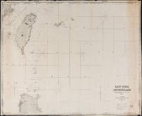
East India Archipelago Chart No. 7 (1878)

East India Archipelago Chart No. 7 (1878): Formosa

by James Imray and Son

  • Used
Condition
Used
Quantity Available
1
Seller
FRAMINGHAM, Massachusetts, United States
Seller rating:
This seller has earned a 5 of 5 Stars rating from Biblio customers.
Item Price
A$1,418.49
A$17.34 shipping to USA

Show Details

Description:
Chart Details:
black and white engraving, navigation lights marked with red and yellow, blue backed
Blue ink stamp next to title block: "Imray & Son London 1878"
Publisher's original paper label glued to back of chart
condition: as found rolled, top left corner approx. 2" piece missing that includes some of perimeter printed border of chart, overall a clean chart with some spotting on edges, some spotting in vicinity of title block, paper toned along right vertical edge chart, edges overall in good condition, this chart was used to plot several voyages and has manuscript pencil notes with dates
Item Price
A$1,418.49
A$17.34 shipping to USA
East India Archipelago Chart No. 2 (1879)

East India Archipelago Chart No. 2 (1879)

by James Imray and Son

  • Used
Condition
Used
Quantity Available
1
Seller
FRAMINGHAM, Massachusetts, United States
Seller rating:
This seller has earned a 5 of 5 Stars rating from Biblio customers.
Item Price
A$157.61
A$17.34 shipping to USA

Show Details

Description:
Chart Details:black and white chart backed with original blue paperdimensions: 41 1/4" x 50 1/2"condition: professionally flattened, good condition, this chart was used for navigationPrice is Net and intended for new collectors.
Item Price
A$157.61
A$17.34 shipping to USA
Vineyard Sound and Buzzard's Bay, Massachusetts 1914
More Photos

Vineyard Sound and Buzzard's Bay, Massachusetts 1914: [Martha's Vineyard, Elizabeth Islands, Chapaquiddick Is.]

by U.S. Coast and Geodetic Survey

  • Used
Condition
Used
Quantity Available
1
Seller
FRAMINGHAM, Massachusetts, United States
Seller rating:
This seller has earned a 5 of 5 Stars rating from Biblio customers.
Item Price
A$906.26
A$17.34 shipping to USA

Show Details

Description:
Details:color lithograph, coast and harbors in green, buoys in redcondition: professionally conserved, paper overall bright and color highlights like new, some yellow toning to paper in lower right quadrant Description:This large scale U.S. Coast and Geodetic Survey of Vineyard Sound & Buzzards Bay, Massachusetts was prepared to be used on board a ship for navigation. The chart shows depth soundings throughout Vineyard Sound and Buzzards's bay, including right to the shoreline. This chart is a color lithograph and employs a green wash to show shallower water and shoals, an unusual feature for the charts in this series that are typically black and white only. Tides and magnetic variations are presented in charts. Buoys are shown in red.
Martha's Vineyard and Chappaquidick Island are shown in their totality. The Elizabeth Islands, a chain of five private islands that lie between Buzzard's Bay and Vineyard Sound, creating an island border are shown also in fine detail, with certain… Read More
Item Price
A$906.26
A$17.34 shipping to USA
Buzzard's Bay, Massachusetts 1913

Buzzard's Bay, Massachusetts 1913: [Elizabeth Islands]

by U.S. Coast and Geodetic Survey

  • Used
Condition
Used
Quantity Available
1
Seller
FRAMINGHAM, Massachusetts, United States
Seller rating:
This seller has earned a 5 of 5 Stars rating from Biblio customers.
Item Price
A$1,891.32
A$17.34 shipping to USA

Show Details

Description:
Details:black and white lithograph, red color highlightscondition: professionally conserved, paper toned and overall clean and in good conditionDescription:This large scale U.S. Coast and Geodetic Survey of Buzzards Bay, Massachusetts was prepared to be used on board a ship for navigation. The chart shows depth soundings throughout Vineyard Sound and Buzzards's Bay, including right to the shoreline. This chart is a black and white lithograph and at this scale provides detailed topographical and nautical information graphically. Grey tones are employed to show water depths and topographic features. The graphic quality of the chart is crisp. Tides and magnetic variations are presented in charts. Buoys are shown in red.
The chart features the Elizabeth Islands, a chain that includes Cuttyhunk and the five private islands in this island chain lying between Buzzard's Bay and Vineyard Sound. The West End of Cuttyhunk has a small fresh water pond labeled West End Pond that itself holds a small… Read More
Item Price
A$1,891.32
A$17.34 shipping to USA
Buzzard's Bay, Massachusetts 1913

Buzzard's Bay, Massachusetts 1913

by U.S. Coast and Geodetic Survey

  • Used
Condition
Used
Quantity Available
1
Seller
FRAMINGHAM, Massachusetts, United States
Seller rating:
This seller has earned a 5 of 5 Stars rating from Biblio customers.
Item Price
A$1,891.32
A$17.34 shipping to USA

Show Details

Description:
details:black and white lithograph, color highlightsdimensions: 46" x 36"condition: professionally conserved, paper toned and overall clean and in good conditionDescription: This large scale U.S. Coast and Geodetic Survey of Buzzards Bay, Massachusetts was prepared to be used on board a ship for navigation. The chart shows depth soundings throughout Vineyard Sound and Buzzards's Bay, including right to the shoreline. This chart is a black and white lithograph and at this scale provides detailed topographical and nautical information graphically. Grey tones are employed to show water depths and topographic features. The graphic quality of the chart is crisp. Tides and magnetic variations are presented in charts. Buoys are shown in red.
The chart features the Elizabeth Islands, a chain that includes Cuttyhunk and the five private islands in this island chain lying between Buzzard's Bay and Vineyard Sound. The West End of Cuttyhunk has a small fresh water pond labeled West End Pond that… Read More
Item Price
A$1,891.32
A$17.34 shipping to USA
Add to Want List

Didn’t find what you’re looking for?

Try adding this search to your want list. Millions of books are added to our site everyday and when we find one that matches your search, we’ll send you an email. Best of all, it’s free.

Add to Want List
Book lovers can save on books by joining our Bibliophiles club

Are you a frequent reader or book collector?

Join the Bibliophile's Club and save 10% on every purchase, every day — up to $20 savings per order!

Biblio is a socially responsible company

Social Responsibility

Did you know that since 2004, Biblio has used its profits to build 16 public libraries in rural villages of South America?