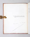
A Geological Map of England & Wales, and Part of Scotland, Showing also the Inland Navigation by Means of Rivers and Canals, with their Elevation in Feet Above the Sea Together with the Rail Roads & Principal Roads
by WALKER, J. & C. [& KNIPE, J.A.]
- Used
- Hardcover
- Condition
- See description
- Seller
-
Lewes, East Sussex, United Kingdom
Payment Methods Accepted
About This Item
London: J. & C. Walker, March 31st, 1837.. Map dimensions 134.5 x 98 cm, overall 143 x 100 cm. Large folding geological map with a cross-section of southern England from Land's End to the German Ocean across the lower margin, all vividly coloured according to the strata, scale: 10 miles to 1 1/8th inch, the map divided into 36 sections and mounted on linen, textured paper to the folded end sections, folds into the original purple embossed cloth slipcase with a gold lettered paper label to the upper panel. Slight discolouration to the case, otherwise this and the map in very good condition. The map was first published in 1835 and was frequently updated and reissued using fresh evidence gathered from geological fieldwork. It has been suggested that up to nine states had appeared by 1838. This is an intermediate state with Knipe's name excised from the title, but with the Walkers' address given as No. 9 Castle Street, Holborn.
Reviews
(Log in or Create an Account first!)
Details
- Bookseller
- Bow Windows Bookshop
(GB)
- Bookseller's Inventory #
- 33595
- Title
- A Geological Map of England & Wales, and Part of Scotland, Showing also the Inland Navigation by Means of Rivers and Canals, with their Elevation in Feet Above the Sea Together with the Rail Roads & Principal Roads
- Author
- WALKER, J. & C. [& KNIPE, J.A.]
- Book Condition
- Used
- Quantity Available
- 1
- Binding
- Hardcover
- Publisher
- London: J. & C. Walker, March 31st
- Date Published
- 1837.
- Keywords
- Maps & Atlases British Isles MAPS Geology England & Wales
Terms of Sale
Bow Windows Bookshop
14 day return guarantee, with full refund including original shipping costs for up to 14 days after delivery if an item arrives misdescribed or damaged.
About the Seller
Bow Windows Bookshop
Biblio member since 2006
Lewes, East Sussex
About Bow Windows Bookshop
Bow Windows Bookshop has a large general stock of old and fine books and maps. Owned in partnership by Ric Latham and Jonathan Menezes, we buy and sell all manner of titles from early leatherbound volumes to modern first editions. We exhibit at bookfairs in the UK and North America and issue regular printed catalogues. Located in the beautiful county town of Lewes in the south-east of England, we are open six days a week. All our books are described as accurately as possible and we abide by the Code of Good Practice of the Antiquarian Booksellers Association
Glossary
Some terminology that may be used in this description includes:
- Cloth
- "Cloth-bound" generally refers to a hardcover book with cloth covering the outside of the book covers. The cloth is stretched...


