Click for full-size.
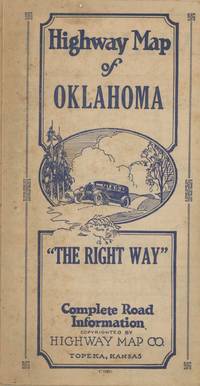
Highway Map of Oklahoma. "The Right Way." Complete Road Information
by [Great Depression - Automobile Travel - Oklahoma] Author Unknown
- Used
- very good
- Condition
- Very Good
- Seller
-
Marlboro, Vermont, United States
Payment Methods Accepted
About This Item
Topeka, 1930. Folded map measuring 28 x 17 inches. Some small tears at folds, very good. Very Good. A scarce depression-era map of Oklahoma, with graphic advertisements to the verso showing the range of automobile-centric establishments in the state at the time. The map shows all the automobile routes of the time, with text along the borders listing the towns and the telephone numbers of various services and lodging options. The instructions on the the top read "Put Out Your Fires / Leave a Clean Camp / Keep the Streams Pure / Don't Be a Road Hog." According to the single copy in OCLC, at the Denver Public Library, the map was printed in 1930, though we see no date on the map itself. The depression hit Oklahoma following the drought in 1930, which also coincided with the opening of the East Texas oil field. This map is a relic of the period just before the state's economic downturn, with the early automobile infrastructure still intact and vibrant.
Reviews
(Log in or Create an Account first!)
Details
- Seller
- Auger Down Books
 (US)
(US)
- Seller's Inventory #
- List2430
- Title
- Highway Map of Oklahoma. "The Right Way." Complete Road Information
- Author
- [Great Depression - Automobile Travel - Oklahoma] Author Unknown
- Format/Binding
- Folded map measuring 28 x 17 inches. Some small tears at folds, very good
- Book Condition
- Used - Very Good
- Quantity Available
- 1
- Place of Publication
- Topeka
- Date Published
- 1930
Terms of Sale
Auger Down Books
30 day return guarantee, with full refund including shipping costs for up to 30 days after delivery if an item arrives misdescribed or damaged.
About the Seller
Auger Down Books
Biblio member since 2012
Marlboro, Vermont
About Auger Down Books
Auger Down Books is a small and highly curated store focusing on American history through photographs, archives, documents and graphics. I issue catalogs and lists via email, and also work directly with curators looking to develop and diversify their collections. Please contact me if you would like to receive my lists or if I may be of assistance in collection development. Thanks for looking!
Glossary
Some terminology that may be used in this description includes:
- Verso
- The page bound on the left side of a book, opposite to the recto page.

Collecting the 1939 New York World’s Fair
Born in the midst of the Great Depression, the theme of the 1939 World’s Fair was “The World of Tomorrow” - a theme that captured the hearts of a generation. Check out the maps, souvenirs, and other ephemera on Biblio!

Is your family bible valuable?
While they may have sentimental value, bibles passed down through the family are not often worth a lot of money. Learn more...