Description:
Philadelphia: Barker Moore & Mein Medicine Co.. Very Good+. ca. 1910. Softcover. No date: Ca: 1910. Clean soft pictorial covers with cloth spine. Text tight, clean & intact. . Pages lightly age toned. B/W drawing illustrations. Humor based on ethnic, racial or sexual stereotypes. Comic book filled with cartoons, stories & jokes - all have one of Barker's products as the punch line. Humor; B&W Drawing; Oblong 16mo 6" - 7" tall; Unpaginated pages .
A New American Atlas containing Maps of the Several States of the North American Union, projected and drawn on a uniform scale from documents found in public offices of the United States and State Governments, and other original and authentic information by Henry S. Tanner by TANNER, H.[enry] S.[chenck] (1786-1858) - 1825
by TANNER, H.[enry] S.[chenck] (1786-1858)
Similar copies are shown below.
Similar copies are shown to the right.
![A New American Atlas containing Maps of the Several States of the North American Union, projected and drawn on a uniform scale from documents found in public offices of the United States and State Governments, and other original and authentic information by Henry S. Tanner by TANNER, H.[enry] S.[chenck] (1786-1858) - 1825](https://d3525k1ryd2155.cloudfront.net/h/911/446/236446911.0.m.jpg)
A New American Atlas containing Maps of the Several States of the North American Union, projected and drawn on a uniform scale from documents found in public offices of the United States and State Governments, and other original and authentic information by Henry S. Tanner
by TANNER, H.[enry] S.[chenck] (1786-1858)
- Used
Philadelphia: H.S. Tanner, 1825. Folio. (23 1/2 x 16 1/2 inches). Letterpress half-title, 1p. index and 18pp. text. Engraved title with vignette of the "First Landing of Columbus in the New World, 21 fine hand-coloured engraved map sheets (16 maps on 16 double-page sheets; 1 map on one folding sheet; and 1 map on 4 double-page sheets), some expert restoration to corners. Expertly bound to style in half brown straight-grained morocco over contemporary marbled paper-covered boards, the flat spine divided into six compartments by double gilt rules, lettered in the second compartment, the others with repeat decoration in gilt, contained within a modern red morocco-backed cloth box, the spine in seven compartments with raised bands, lettered in the second, the others with repeat tooling in gilt
A fine copy of the improved second edition of "one the most magnificent atlases ever published in the United States" (Ristow).
Tanner's New American Atlas contained the most accomplished series of maps of America that had yet appeared in an atlas. Of the greatest importance were the maps of American states, which were highly detailed and brilliantly coloured. While New York and Florida each had their own dedicated page, other double-page sheets showcased multiple states at a time. As the title claims, these maps were drawn up using a careful combination of original surveys and the best existing published sources. The evident high cost of production meant that the publishers took the decision to issue the maps originally in five separate parts which were published from 1819 to 1823. A first collected edition was published in 1823, and this second revised edition appeared in 1825. The maps, all of which are carefully hand-coloured, include a world map, 4 maps of continents, a map of South America on a large folding sheet made up from two joined sheets (the index calls for two separate sheets), a map of North America on 4 sheets and 11 double-page maps of the various States. The very large map of North America is of particular beauty and note. Wheat writes: "This map was a landmark - a great cartographical achievement ... Tanner made good use of a large number of intervening map, those of interest here being Humboldt's 'New Spain,' Pike's various maps, Long's map, and 'Pedro Walker's Map of New California ... This 1822 map of North America was the progenitor of a long line of famous maps" (Wheat, II: pp. 82-87) Contemporary reviews were favourable: the New American Atlas "is decidedly one of the most splendid works of the kind ever executed in this country" (United States Gazette, September 1823). Never "has either America or Europe, produced a geographical description of the several States of the Union, so honorable to the Arts, and so creditable to the nation as Tanner's American Atlas." (National Advocate 25 August 1824). Perhaps the most enthusiastic report came from the scholar Jared Sparks who wrote in the April 1824 issue of the North American Review that "as an American Atlas, we believe Mr. Tanner's work to hold a rank far above any other, which has been published." This second edition is notable for the significant cartographic changes made by Tanner, reflecting new boundaries, counties, towns and discoveries since the initial maps were published. For example, the map of Illinois shows significant changes to the mapping of the headwaters of the Mississippi, and the map of Louisiana depicts Indian lands with vast changes from the first edition.
Howes T29; Phillips 3669; cf. Ristow, American Maps and Map Makers, pp. 193-198; Rumsey 2755; Sabin 94323.
-
Bookseller
Donald Heald Rare Books
 (US)
(US)
- Format/Binding Folio
- Book Condition Used
- Quantity Available 1
- Publisher H.S. Tanner
- Place of Publication Philadelphia
- Date Published 1825
We have 2 copies available starting at A$23.18.

BARKER'S "KOMIC" PICTURE SOUVENIR, PART 3 Revised in 4 Parts
by Barker Moore & Mein Medicine Co.
- Used
- Paperback
- Condition
- Used - Very Good+
- Binding
- Paperback
- Quantity Available
- 1
- Seller
-
Fairfield, New Jersey, United States
- Item Price
-
A$348.86
Show Details
Item Price
A$348.86

More Photos
A New American Atlas containing Maps of the Several States of the North American Union, projected and drawn on a uniform scale from documents found in public offices of the United States and State Governments, and other original and authentic information by Henry S. Tanner
by TANNER, H.[enry] S.[chenck] (1786-1858)
- Used
- Condition
- Used
- Binding
- Unknown
- Quantity Available
- 1
- Seller
-
New York, New York, United States
- Item Price
-
A$93,030.00
Show Details
Description:
Philadelphia: H.S. Tanner, 1823. Folio. (24 x 16 3/4 inches). Letterpress half-title, 1p. index and 18pp. text. Engraved title with vignette of the "First Landing of Columbus in the New World", 18 fine hand-coloured engraved maps (16 double-page, 2 folding). Expertly bound to style in half-calf over contemporary marbled paper-covered boards, the flat spine gilt and divided into seven compartments by fillets and roll tools, lettered in the second compartment, the others with repeat decoration in gilt, marbled endpapers A fine copy of the first collected edition of "the most distinguished atlas published in the United States during the engraving period" (Ristow). Tanner's New American Atlas contained the most accomplished series of maps of America that had yet appeared in an atlas. Of the greatest importance were the maps of American states. These maps were drawn up using a careful combination of original surveys and the best existing published sources. The evident high cost of production meant that…
Read More Item Price
A$93,030.00
![[Hariot's Virginia] Admiranda narratio fida tamen, de commodis et incolarum ritibus Virginiae ......](https://d3525k1ryd2155.cloudfront.net/h/132/126/359126132.0.m.jpg)
More Photos
[Hariot's Virginia] Admiranda narratio fida tamen, de commodis et incolarum ritibus Virginiae ... Anglico scripta sermone, a Thoma Hariot
by HARIOT, Thomas, [and John WHITE]. - Theodor DE BRY and Johann Theodor DE BRY
- Used
- Condition
- Used
- Binding
- Unknown
- Quantity Available
- 1
- Seller
-
New York, New York, United States
- Item Price
-
A$100,782.50
Show Details
Description:
Frankfurt: Typis Johannis Wecheli, Sumtibus vero Johannis-Theodori de Bry, 1608. Folio. (13 1/4 x 9 inches). Collation: a4, b6, c4, d6, *2, A6, B-C8, D6, E8, F5. Title page to text with two pasted on paper panels bearing the title and publishing details in Latin, all within an engraved surround (as issued), letterpress title to plates, engraved arms on dedication leaf, blank D6. 1 double-page engraved map of Virginia [Burden 76, state 2], 1 engraved plate of Adam and Eve (first state with inscription "Iodocus a Winghe in / / Theodore de Bry fe", 27 engraved plates after John White (including 5 plates of Picts), with blank D6 but without the final blank F6 (as in Church), various small neat expert repairs, three leaves misbound. Expertly bound to style in 18th-century blue/green morocco, covers with gilt roll tool border, the flat spine divided into six compartments with gilt roll tools and fillets, lettered in the second compartment, the others tooled with alternating neo-classical tools,…
Read More Item Price
A$100,782.50
More Photos
Moral Culture of Infancy, and Kindergarten Guide
by Mann, Mrs. Horace/Peabody, Elizabeth P Mann, Mrs. Horace (Co-Author); Peabody, Elizabeth P (Co-Author)
- Used
- fair
- Hardcover
- Condition
- Used - Fair
- Edition
- Third edition
- Binding
- Hardcover
- Quantity Available
- 1
- Seller
-
Salida, Colorado, United States
- Item Price
-
A$69.77
Show Details
Description:
New York: J.W. Schemerhorn & Co., 1870. Third edition. Hardcover. Fair. New York: J.W. Schemerhorn & Co., 1870. Third edition. Fair. Covers and spine are soiled and faded, a couple of tears in the cloth on the spine cover, bumping. Front hinge coming loose but pages tight in binding, some foxing to contents.
Item Price
A$69.77

More Photos
Atlas des Indes Occidentales, ou Description Géo-Hydrographique des Régions, des Côtes, des Isles, & des Mers, connues sous le nom d'Indes Occidentales, dans laquelle On trouve réunis tous les Détails Géographiques & Nautiques qui appartiennent à c... - [THE WEST-INDIES]
by JEFFERYS, THOMAS.
- Used
- Hardcover
- Condition
- Used
- Binding
- Hardcover
- Quantity Available
- 1
- Seller
-
Copenhagen, Denmark
- Item Price
-
A$49,500.00
Show Details
Description:
1777. London, Robert Sayer & Jean Bennett, 1777. [Engraved title: London, Sayer & Bennett, 1775]. Folio. Recently bound in a magnificent pastiche-binding of brown half calf with six raised bands and gilt red leather title-label to elaborately gilt spine. Vellum corners and lovely marbled paper over boards. The binding is made over the original one, preserving the original sewn spine underneath as well as the original end-papers. An excellent, beautiful copy. Very clean and fresh. Only minor, light browning to a few maps, and last map with a bit more staining. One map with a small tear to lower margin, far from effecting engraving. Previously in the possession the Danish medieval estate Ravnholt, since the 18th century owned by the noble family of Sehestedt Juul, with discreet stamps from this ownership to title-page: "Sehestedt Juel" and "Rauenholdts Bibliothek". Title-page (French) + 6 pp. of preface (French) + (2) pp. of index (French) + double-page engraved, illustrated title (English) + 36…
Read More Item Price
A$49,500.00
BARKER'S "KOMIC" PICTURE SOUVENIR, PART 3 Revised in 4 Parts
by Barker Moore & Mein Medicine Co.
- Used
- Paperback
- Condition
- Used - Very Good+
- Binding
- Paperback
- Quantity Available
- 1
- Seller
-
Fairfield, New Jersey, United States
- Item Price
-
A$348.86
Show Details
Description:
Philadelphia: Barker Moore & Mein Medicine Co.. Very Good+. ca. 1910. Softcover. No date: Ca: 1910. Clean soft pictorial covers with cloth spine. Text tight, clean & intact. . Pages lightly age toned. B/W drawing illustrations. Humor based on ethnic, racial or sexual stereotypes. Comic book filled with cartoons, stories & jokes - all have one of Barker's products as the punch line. Humor; B&W Drawing; Oblong 16mo 6" - 7" tall; Unpaginated pages .
Item Price
A$348.86
More Photos
A New American Atlas containing Maps of the Several States of the North American Union, projected and drawn on a uniform scale from documents found in public offices of the United States and State Governments, and other original and authentic information by Henry S. Tanner
by TANNER, H.[enry] S.[chenck] (1786-1858)
- Used
- Condition
- Used
- Binding
- Unknown
- Quantity Available
- 1
- Seller
-
New York, New York, United States
- Item Price
-
A$93,030.00
Show Details
Description:
Philadelphia: H.S. Tanner, 1823. Folio. (24 x 16 3/4 inches). Letterpress half-title, 1p. index and 18pp. text. Engraved title with vignette of the "First Landing of Columbus in the New World", 18 fine hand-coloured engraved maps (16 double-page, 2 folding). Expertly bound to style in half-calf over contemporary marbled paper-covered boards, the flat spine gilt and divided into seven compartments by fillets and roll tools, lettered in the second compartment, the others with repeat decoration in gilt, marbled endpapers A fine copy of the first collected edition of "the most distinguished atlas published in the United States during the engraving period" (Ristow). Tanner's New American Atlas contained the most accomplished series of maps of America that had yet appeared in an atlas. Of the greatest importance were the maps of American states. These maps were drawn up using a careful combination of original surveys and the best existing published sources. The evident high cost of production meant that…
Read More Item Price
A$93,030.00
More Photos
[Hariot's Virginia] Admiranda narratio fida tamen, de commodis et incolarum ritibus Virginiae ... Anglico scripta sermone, a Thoma Hariot
by HARIOT, Thomas, [and John WHITE]. - Theodor DE BRY and Johann Theodor DE BRY
- Used
- Condition
- Used
- Binding
- Unknown
- Quantity Available
- 1
- Seller
-
New York, New York, United States
- Item Price
-
A$100,782.50
Show Details
Description:
Frankfurt: Typis Johannis Wecheli, Sumtibus vero Johannis-Theodori de Bry, 1608. Folio. (13 1/4 x 9 inches). Collation: a4, b6, c4, d6, *2, A6, B-C8, D6, E8, F5. Title page to text with two pasted on paper panels bearing the title and publishing details in Latin, all within an engraved surround (as issued), letterpress title to plates, engraved arms on dedication leaf, blank D6. 1 double-page engraved map of Virginia [Burden 76, state 2], 1 engraved plate of Adam and Eve (first state with inscription "Iodocus a Winghe in / / Theodore de Bry fe", 27 engraved plates after John White (including 5 plates of Picts), with blank D6 but without the final blank F6 (as in Church), various small neat expert repairs, three leaves misbound. Expertly bound to style in 18th-century blue/green morocco, covers with gilt roll tool border, the flat spine divided into six compartments with gilt roll tools and fillets, lettered in the second compartment, the others tooled with alternating neo-classical tools,…
Read More Item Price
A$100,782.50
More Photos
Moral Culture of Infancy, and Kindergarten Guide
by Mann, Mrs. Horace/Peabody, Elizabeth P Mann, Mrs. Horace (Co-Author); Peabody, Elizabeth P (Co-Author)
- Used
- fair
- Hardcover
- Condition
- Used - Fair
- Edition
- Third edition
- Binding
- Hardcover
- Quantity Available
- 1
- Seller
-
Salida, Colorado, United States
- Item Price
-
A$69.77
Show Details
Description:
New York: J.W. Schemerhorn & Co., 1870. Third edition. Hardcover. Fair. New York: J.W. Schemerhorn & Co., 1870. Third edition. Fair. Covers and spine are soiled and faded, a couple of tears in the cloth on the spine cover, bumping. Front hinge coming loose but pages tight in binding, some foxing to contents.
Item Price
A$69.77
More Photos
Atlas des Indes Occidentales, ou Description Géo-Hydrographique des Régions, des Côtes, des Isles, & des Mers, connues sous le nom d'Indes Occidentales, dans laquelle On trouve réunis tous les Détails Géographiques & Nautiques qui appartiennent à c... - [THE WEST-INDIES]
by JEFFERYS, THOMAS.
- Used
- Hardcover
- Condition
- Used
- Binding
- Hardcover
- Quantity Available
- 1
- Seller
-
Copenhagen, Denmark
- Item Price
-
A$49,500.00
Show Details
Description:
1777. London, Robert Sayer & Jean Bennett, 1777. [Engraved title: London, Sayer & Bennett, 1775]. Folio. Recently bound in a magnificent pastiche-binding of brown half calf with six raised bands and gilt red leather title-label to elaborately gilt spine. Vellum corners and lovely marbled paper over boards. The binding is made over the original one, preserving the original sewn spine underneath as well as the original end-papers. An excellent, beautiful copy. Very clean and fresh. Only minor, light browning to a few maps, and last map with a bit more staining. One map with a small tear to lower margin, far from effecting engraving. Previously in the possession the Danish medieval estate Ravnholt, since the 18th century owned by the noble family of Sehestedt Juul, with discreet stamps from this ownership to title-page: "Sehestedt Juel" and "Rauenholdts Bibliothek". Title-page (French) + 6 pp. of preface (French) + (2) pp. of index (French) + double-page engraved, illustrated title (English) + 36…
Read More Item Price
A$49,500.00

A New American Atlas Containing Maps Of The Several States Of The North American Union / A General Atlas, Book Review
by Tanner, Henry Schenck / Fielding Lucas, Publisher
- Used
- good
- Paperback
- Condition
- Used - Good
- Binding
- Paperback
- Quantity Available
- 1
- Seller
-
Louisville, Kentucky, United States
- Item Price
-
A$23.18
Show Details
Description:
Boston: O. Everett, 1824. Book. Good. Soft cover. 8vo. 9pp extract, salvaged from a damaged issue of The North American Review, Volume XVIII, No. 43, April, 1824. A contemporary review of the scarce titles published in Philadelphia, 1823, and Fielding Lucas, Baltimore, 1823, respectively. Housed in protective mylar report cover..
Item Price
A$23.18

More Photos
A new American atlas : containing maps of the several states of the North American Union
by Henry Schenck Tanner
- Used
- good
- Hardcover
- first
- Condition
- Used - Good
- Edition
- First Edition
- Binding
- Hardcover
- Quantity Available
- 1
- Seller
-
Boonsboro, Maryland, United States
- Item Price
-
A$45,584.70
Show Details
Description:
Philadelphia : H.S. Tanner, 1823. First Edition. Hardcover. Good. Atlas folio, 60.5 x 43 cm. Contemporary leather backed boards, rebacked with new spine. Solid binding and cover. Complete with 22 hand-colored, copper engraved maps. A few of the maps have marginal restoration or restoration at center folds. Corners bumped. Half-title has some marginal chipping. Engraved title showing Columbus landing in the New World has some toning, minor spotting. 18 text pages (one provided in facsimile). Manuscript map of Cape Cod on verso of map 17. <br> Refs: Howes T29; Sabin 94319; Phillips 1374; Schwartz and Ehrenberg, Mapping of America, p. 251; Wheat Transmississippi 350; Rumsey 2892. <br> What makes the Tanner Atlas special is that it was so much better than other contemporary American atlases and that it was uniform in scale, updated with recent discoveries in the interior of North America (Tanner consulted Lewis and Clarks actual maps to devise his atlas) and in an large and opulent…
Read More Item Price
A$45,584.70

Attempt on Roosevelt Life
by nebraska state journal
- Used
- Condition
- Used
- Quantity Available
- 1
- Seller
-
Lincoln, Nebraska, United States
- Item Price
-
A$15.50
Show Details
Description:
full
Item Price
A$15.50

Cap'n Kid Goes To The South Pole
by Engle, Joanna
- Used
- good
- Paperback
- first
- Condition
- Used - Good
- Jacket Condition
- None Issued
- Edition
- First Edition
- Binding
- Paperback
- ISBN 10 / ISBN 13
- 9780394856438 / 0394856430
- Quantity Available
- 1
- Seller
-
Salem, Oregon, United States
- Item Price
-
A$38.76A$23.26Save A$10.00!
Show Details
Description:
Engle, Joanna. Cap'n Kid Goes To The South Pole. A Seaworld Adventure featuring Shamu, the Killer Whale. RARE. Children's Book. Used. Good, clean Condition. Softcover. Stapled binding. Random House copyright 1983. 5 ½ X 5. ISBN 0394856430. Original cover price $1.25.
Item Price
A$38.76A$23.26
Save A$10.00
!

The Treasure Of Sierra Madre
by Traven, B
- Used
- Hardcover
- first
- Condition
- Used - Good-
- Jacket Condition
- No DJ Included
- Edition
- Large-Print Edition
- Binding
- Hardcover
- ISBN 10 / ISBN 13
- 9780786201006 / 0786201002
- Quantity Available
- 1
- Seller
-
Salem, Oregon, United States
- Item Price
-
A$52.55A$31.52Save A$13.56!
Show Details
Description:
Traven, B. : The Treasure Of Sierra Madre. 1994 THORNDIKE PRESS LARGE-PRINT EDITION. Thorndike, Maine. EXLIB. Good/ No DJ if issued. ISBN0786201002. 533 pages. 5 ¾ X 8 ¾. Summary: "The story of three American adventurers who search for a lost gold mine in the mountains of Mexico. A tale of 'gold fever' and desperate greed." Basis for the Humphrey Bogart, John Houston film of the same name.
Item Price
A$52.55A$31.52
Save A$13.56
!

Oregon; Or, a Short History of a Long Journey: Narrative of a Journey Across the Rocky Mountains, to the Columbia River
by John B. Wyeth
- Used
- very good
- Hardcover
- Condition
- Used - Very Good
- Edition
- Limited Edition
- Binding
- Hardcover
- Quantity Available
- 1
- Seller
-
Longmont, Colorado, United States
- Item Price
-
A$31.01
Show Details
Description:
YE Gallon Press, 1970. Limited Edition. #499/605. VG. Interior is tight, clean, and free of ownership marks except for one penciled notation on the flyleaf. Cloth boards show shelf and handling wear with light soiling, edge, corner, and spine wear. Overall a solid copy showing minimal signs of use. Photo is of the copy we have here at Barbed Wire Books.
Item Price
A$31.01
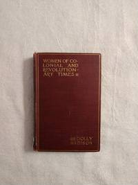
DOLLY MADISON: WOMEN OF COLONIAL AND REVOLUTIONARY TIMES
by Goodwin, Maud Wilder
- Used
- good
- Hardcover
- first
- Condition
- Used - Good
- Edition
- First Edition
- Binding
- Hardcover
- Quantity Available
- 1
- Seller
-
Buffalo, Wyoming, United States
- Item Price
-
A$42.64
Show Details
Description:
New York: Charles Scribner's Sons, 1886. First Edition . Hardcover. Good. 12mo - over 6¾" - 7¾" tall. Book is in G condition with light rubbing to edges, cocked spine, bumping & fraying to spine ends, pencil marking to FFE, owner's name to title page, a couple of small tears to title page else still a bright and solid copy. SA 6/21
Item Price
A$42.64

More Photos
Grant Wood and Marvin Cone : Artists of an Era
by Hazel E. Brown
- Used
- near fine
- Hardcover
- Signed
- first
- Condition
- Used - Near Fine
- Jacket Condition
- Very Good
- Edition
- First Edition
- Binding
- Hardcover
- ISBN 10 / ISBN 13
- 9780813817750 / 0813817757
- Quantity Available
- 1
- Seller
-
Arlington, Virginia, United States
- Item Price
-
A$43.34
Show Details
Description:
Ames: Iowa State University Press, 1972. Hardcover. First Edition (stated). Flat signed and dated by author on FFEP and Inscribed by author to a friend on half-title page. Near Fine book in a Very Good jacket. Interior pristine except for author's inscription and signature. Spine straight and tight. Jacket shows light rubbing, light chipping at spine head, and light reading wear to edges. Not from a library. No remainder mark. Not clipped. xi + 150 pages. illus. A reflection of the relationships of two artists -- Grant Wood (1891-1942) and Marvin Cone (1891-1965) -- with the community of Cedar Rapids, Iowa. A loving biography by a woman who knew them both. Laid-in are two letters to the editor of the Cedar Rapids Gazette; one from Woods' sister, and another from a friend of Woods and the author.
Item Price
A$43.34

More Photos
BOSTON ~ 150 VIEWS: One Hundred and Fifty Glimpses of Boston and Historical Surroundings
- Used
- very good
- Paperback
- Condition
- Used - Very Good
- Binding
- Paperback
- Quantity Available
- 1
- Seller
-
Surrey, British Columbia, Canada
- Item Price
-
A$34.02
Show Details
Description:
Union News Company , New York and Boston, circa 1910, Very Good Stapled Softcover, 50 pages, 10" x 7", 150 photographs of Boston points of interest, landmarks, buildings, bridges, street views and more.
Item Price
A$34.02
More Photos
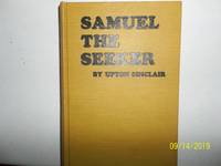
Samuel The Seeker
by Sinclair, Upton
- Used
- very good
- Hardcover
- first
- Condition
- Used - Very Good
- Jacket Condition
- No DJ Included
- Edition
- First Edition
- Binding
- Hardcover
- Quantity Available
- 1
- Seller
-
Salem, Oregon, United States
- Item Price
-
A$62.02A$37.21Save A$16.00!
Show Details
Description:
Sinclair, Upton. Samuel, The Seeker Copyright 1910. Apparently published by author. No publisher stated. First Edition. States printed at Western Printing and Lithography, Racine, WI. Yellow Boards with black titling. Used. Very Good/ No Dj is Included. Rare/Scarce. A nice copy.
Item Price
A$62.02A$37.21
Save A$16.00
!

Readin' 'Ritin' 'Rithmetic: Northern San Luis Obispo County Area One-Room Schools; Memories, Photos
by Anderson, Carilyn M. And Franklin, Harold A. And Nelson, Bonnie K. And Radford, Milene F. And Dollen
- Used
- very good
- Paperback
- Condition
- Used - Very Good
- Edition
- No Edition Stated
- Binding
- Paperback
- ISBN 10 / ISBN 13
- 9781929117093 / 1929117094
- Quantity Available
- 1
- Seller
-
Magalia, California, United States
- Item Price
-
A$38.68
Show Details
Description:
El Paso de Robles Area Pioneer Museum. Very Good. 2004. No Edition Stated. Softcover. 1929117094 . Light edgewear, corners of book have light curl, small indentation to front cover; b/w photos; 172 pages .
Item Price
A$38.68

More Photos
The DOs and DON'Ts of Yesterday: Little Book of Early American Know-How
by Eric Sloane
- Used
- Hardcover
- Signed
- Condition
- Like New
- Jacket Condition
- Very Good
- Binding
- Hardcover
- Quantity Available
- 1
- Seller
-
Orange, Virginia, United States
- Item Price
-
A$38.76
Show Details
Description:
Illustrated with pen/ink images Sloane is known for. (2) books,a yellow and an orange (18x12cm) with gilt title on covers and spines. Paper title on dark red slipcase with signature of author. Slipcase has very minor wear to bottom fore edge.
Item Price
A$38.76