Description:
Unbound, colored engraved map, 16" x 13". Some toning and aging, and a little foxing, ample margins; overall in very good condition. Maps are wrapped with acid free board, or in rigid sleeves. Beginning with J. H. Colton (1800-1893), the Colton family published atlases for over 30 years. Colton's Atlas of the World was first published in 1855 in a large two volume set. In 1857 it became Colton's General Atlas, and Colton's sons, George Woolworth and Charles B. would take over the business. This is a map of the Pacific islands from from the 1857 edition of Colton's General Atlas, even though the copyright date on the map indicates 1855. This is a very attractive hemispheric map with good coloring from the 1857 installment of the Colton Atlas. Ristow 313-326.
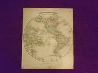
Western Hemisphere by Colton, J.H - 1856
by Colton, J.H
Similar copies are shown below.
Similar copies are shown to the right.

Western Hemisphere
by Colton, J.H
- Used
New York: J.H. Colton, 1856. Other. 398 by 354mm (15¾ by 14 inches).. Steel engraving, handcolored when published. A decorative map from the Western Hemisphere. In excellent condition. 398 by 354mm (15¾ by 14 inches).
-
Bookseller
Antiquariat Reinhold Berg ek
 (DE)
(DE)
- Format/Binding Other
- Book Condition Used
- Quantity Available 1
- Publisher J.H. Colton
- Place of Publication New York
- Date Published 1856
- Keywords Antique map Map:Americas:Americas Americas Colton, J.H. Western Hemisphere New York J.H. Colton 1856
- Product_type map
- Size 398 by 354mm (15¾ by 14 inches).
We have 2 copies available starting at A$92.96.
Colton's Western Hemisphere.
by Colton, J.H
- Used
- Condition
- Used
- Quantity Available
- 1
- Seller
-
Florham Park, New Jersey, United States
- Item Price
-
A$92.96
Show Details
Item Price
A$92.96

MAP: "Western Hemisphere/ Eastern Hemisphere"...from Johnson's New Illustrated (Steel Plate) Family Atlas, 1861
by Colton, J.H. & Johnso, A.J. (compiled, Drawn & Engraved by)
- Used
- very good
- Paperback
- first
- Condition
- Used - Very Good
- Edition
- 1st
- Binding
- Paperback
- Quantity Available
- 1
- Seller
-
Hagerstown, Maryland, United States
- Item Price
-
A$232.41
Show Details
Description:
Richmond, VA: Johnson & Browning, 1861. Plate #4,5: lovely double page map (lite toning) ; hemispheric projections of the world in the mid 19th century. 1st. Unbound. Very Good. Illus. by Handcolored Map. 17 x 24.5 Inches.
Item Price
A$232.41
