Description:
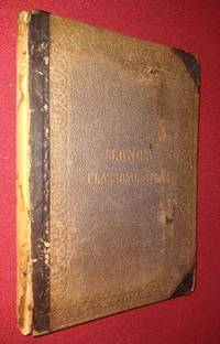
Philadelphia: Henry C. Lea. Good. 1866. Hardcover. Text block unmarked, complete with all maps and securely stiched; binding lacks leather backstrip; cloth covered boards detached and worn at extremities. OCLC 15249384 This book measures 7 by 10 1/4 inches. Thirty-two pages of text, 17 double-page maps on guards (13.5" x 20"), 10 additional single page plates (6.75" X 10"). Maps are nicely engraved with territorial borders hand coloured in blue and red. Subjects include: Britannia, Gallia, Hispania, Italia (northern), Italia (southern), Plan of Rome, Roman Territory of Italy, Sicilia, Syracuse, Macedonia - Thracia-Illyricum, Graecia, Attica-Boetia-Phocus, Plan of Athens, Peloponnesus, Coasts and Islands of Aegean Sea, Asia Minor and Northern Syria, Palaestina, Assyria, Mauritania-Numidia-Africa, Arabia Petraea-Egypt, Germania Magna, and twelve Topographical Plans. Thirty-two pages of text 17 double-page maps, 10 additional single page plates. Less than two…
Read More Search Results: Maps from Antiquarian Book Shop
You searched for:
- Subject: Maps from Antiquarian Book Shop
Results 1 - 9 of 9
More Photos
An Atlas of Classical Geography.with A Sketch of Classical Geography and other Additions: Containing Fifty-two Maps and Plans on Twenty-six Plates, with an Index of Places With a Sketch of Classical Geography
by Hughes, William ; George Long (editor)
- Used
- good
- Hardcover
- Condition
- Used - Good
- Binding
- Hardcover
- Quantity Available
- 1
- Seller
-
Washington, District of Columbia, United States
- Item Price
-
A$69.65A$7.67 shipping to USA
Show Details
Item Price
A$69.65
A$7.67
shipping to USA

Colour Map of ASIA from Zell's Popular Encyclopedia
by Bartholomew, John
- Used
- Condition
- Used - Very Good+
- Quantity Available
- 1
- Seller
-
Washington, District of Columbia, United States
- Item Price
-
A$23.24A$7.67 shipping to USA
Show Details
Description:
Philadelphia: T. Ellwood Zell. Very Good+. 1876. Map. This excellent vintage printed colour map of Asia measures 17" by 12 5/8" Printing details from the bottom margin state Engraved & Printed in Colours - T. Ellwood Zell, Philadelphia - by J. Bartholomew. No date engraved in the plate, but mid to late 1870s from Zell's Popular Encyclopedia. A wonderful representation of the Asian continent as it was geographically configured in the 1870s -- Persia, Beloochistan, China, Eastern Turkestan, India, Burmah, Siam, Annan, etc. There is a faint crease at center where it was mounted in the atlas, otherwise near fine. John Bartholomew, Jr. (1831 – 1893) was a Scottish cartographer. His father John Bartholomew Senior (1805-1861) started a cartographical establishment in Edinburgh, Scotland. In 1856 John, Jr. took up the management of his father's firm John Bartholomew and Son Ltd. Bartholomew is best known for the development of colour contouring to represent…
Read More Item Price
A$23.24
A$7.67
shipping to USA

Colour Map of NORTH AMERICA from Zell's Popular Encyclopedia
by Bartholomew, John
- Used
- Condition
- Used - Very Good+
- Quantity Available
- 1
- Seller
-
Washington, District of Columbia, United States
- Item Price
-
A$23.24A$7.67 shipping to USA
Show Details
Description:
Philadelphia: T. Ellwood Zell. Very Good+. 1876. Map. This excellent vintage printed colour map of North America measures 17" by 12 5/8" Printing details from the bottom margin state Engraved & Printed in Colours - T. Ellwood Zell, Philadelphia - by J. Bartholomew. No date engraved in the plate, but mid to late 1870s from Zell's Popular Encyclopedia. A wonderful representation of North America as it was geographically configured in the 1870s, showing Alaska as a U.S. Territory. There is a faint crease at center where it was mounted in the atlas and a small spot of foxing that barely shows thru in Florida, otherwise near fine. John Bartholomew, Jr. (1831 – 1893) was a Scottish cartographer. His father John Bartholomew Senior (1805-1861) started a cartographical establishment in Edinburgh, Scotland. In 1856 John, Jr. took up the management of his father's firm John Bartholomew and Son Ltd. Bartholomew is best known for the development of colour contouring…
Read More Item Price
A$23.24
A$7.67
shipping to USA

GENERAL MAP of the UNITED STATES from Zell's Popular Encyclopedia
by Bartholomew, John
- Used
- Condition
- Used - Very Good+
- Quantity Available
- 1
- Seller
-
Washington, District of Columbia, United States
- Item Price
-
A$23.24A$7.67 shipping to USA
Show Details
Description:
Philadelphia: T. Ellwood Zell. Very Good+. 1876. Map. This excellent vintage printed colour map of the United States measures 17" by 12 5/8" Printing details from the bottom margin state Engraved & Printed in Colours - T. Ellwood Zell, Philadelphia - by J. Bartholomew. No date engraved in the plate, but mid to late 1870s from Zell's Popular Encyclopedia. A wonderful representation of United States as it was geographically configured in the 1870s showing the Dakotas as a single territory. There is a faint crease at center where it was mounted in the atlas and a small spot of foxing that barely shows through in Florida, otherwise near fine. John Bartholomew, Jr. (1831 – 1893) was a Scottish cartographer. His father John Bartholomew Senior (1805-1861) started a cartographical establishment in Edinburgh, Scotland. In 1856 John, Jr. took up the management of his father's firm John Bartholomew and Son Ltd. Bartholomew is best known for the development of…
Read More Item Price
A$23.24
A$7.67
shipping to USA

MAP OF THE CITY OF WASHINGTON - Showing Location of Fatal Cases of Zymotic Diseases for the Year Ending June 30, 1891 Typhoid Fever, Malarial Fever, Scarlet Fever, Diptheria, Diarrheal Diseases
by [Large map with coloring]
- Used
- first
- Condition
- Used - Very Good-
- Edition
- First Edition
- Quantity Available
- 1
- Seller
-
Washington, District of Columbia, United States
- Item Price
-
A$61.88A$7.67 shipping to USA
Show Details
Description:
Washington, DC: U.S. House of Representatives. Very Good-. 1891. First Edition. Map. Report of the Commissioners of the District of Columbia for 1891; Original 1891 large map of Washington, DC, removed from the Report of the Commissioners of the District of Columbia for 1891. Measures 30" x 29", folded into 36 panels. Minor edgewear, some small closed tears at a couple corners. Photolithography by Norris Peters Company. 52nd Congress (1st Sess.), HED 1 (Part7). Map No. 2. .
Item Price
A$61.88
A$7.67
shipping to USA

MAP OF THE CITY OF WASHINGTON - Location of Deaths for the Year Ending June 30, 1891 "Combined numbers show total deaths on each square. Deaths of white persons are shown by numbers in red. Those of colored persons by numbers in blue.
by [Large map with coloring]
- Used
- very good
- first
- Condition
- Used - Very Good
- Edition
- First Edition
- Quantity Available
- 1
- Seller
-
Washington, District of Columbia, United States
- Item Price
-
A$61.88A$7.67 shipping to USA
Show Details
Description:
Washington, DC: U.S. House of Representatives. Very Good. 1891. First Edition. Map. Report of the Commissioners of the District of Columbia for 1891; Original 1891 large map of Washington, DC, removed from the Report of the Commissioners of the District of Columbia for 1891. Measures 30" x 29", folded into 36 panels. Minor edgewear, some small closed tears at a couple corners, one panel has a split along one horizontal fold. Photolithography by Norris Peters Company. 52nd Congress (1st Sess.), HED 1 (Part7). Map No. 1. .
Item Price
A$61.88
A$7.67
shipping to USA

Map of South Asia and Southeast Asia and parts of Central Asia
by Fischer, Hans
- Used
- very good
- Condition
- Used - Very Good
- Quantity Available
- 1
- Seller
-
Washington, District of Columbia, United States
- Item Price
-
A$54.14A$7.67 shipping to USA
Show Details
Description:
Leipzig: Wagner and Debes. Very Good. 1914. Map. 1 pages; Large colour map measures 20" x 15.5" folded to 3.75" x 5.5" Four tiny marginal tears (not affecting map); one closed 2 inch tear at left edge (no loss of image). Vintage map of Central and South Asia, includes India, Tibet, Burma, Siam, French Indo-China, some parts of Afghanistan, Baluchistan and China, as well as Gulf of Bengal and South China Sea produced by Geographischen Anstalt Wagner and Debes. The map is drawn to the scale of 1:10,000,000 (10mm: 100 kilometers) This map was published in the Baedeker guide Indien published in 1914. .
Item Price
A$54.14
A$7.67
shipping to USA
More Photos
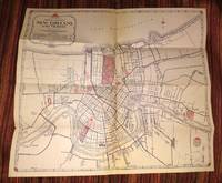
New Orleans and Vicinity
by AAA - American Automobile Association
- Used
- very good
- Condition
- Used - Very Good
- Quantity Available
- 1
- Seller
-
Washington, District of Columbia, United States
- Item Price
-
A$23.16A$7.67 shipping to USA
Show Details
Description:
New Orleans: American Automobile Association. Very Good. 1948. Map. Clean and complete folding map of New Orleans and Vicinity measuring 18" X 16". Verso has text and a second more detailed map of Metropolitan New Orleans. A relic of the preferred mode of travel in mid-20th century America. A Triple A road map for a great tourist destination - New Orleans. .
Item Price
A$23.16
A$7.67
shipping to USA

More Photos
PHILIPS HANDY GENERAL CENTENARY ATLAS OF THE WORLD
by Philip, George, F.R.G.S. (editor
- Used
- Hardcover
- Condition
- Used - Very Good-
- Edition
- Fourth Edition
- Binding
- Hardcover
- Quantity Available
- 1
- Seller
-
Washington, District of Columbia, United States
- Item Price
-
A$232.32A$7.67 shipping to USA
Show Details
Description:
London: George Philip & Son, Ltd. Very Good-. 1934. Fourth Edition. Hardcover. Contents complete, no inscriptions - a date Jan 1939, maps all present and in very nice condition, only endpapers are foxxed. The maps are mounted on guards, so the folds are NOT worked into the binding. Secure in original green cloth binding, 2" piece of cloth missing at base of spine. A very impressive atlas. A series of 116 large double page coloured maps and plans forming a complete, geographical survey of the international relationships of the new era, its territorial changes, and commercial communications followed by an index of over 116,000 names (169 pp). Some of the double-page maps, have an additional fold-out panel. The maps measure either 39.5 cm X 52 cm or 39.5 cm X 67 cm. The atlas sections are divided by continents with thumb tabs for each. Some of the more interesting double-page maps include: Persia, East Indies and China Sea, Japanese Empire, South and Central Russia,…
Read More Item Price
A$232.32
A$7.67
shipping to USA

Didn’t find what you’re looking for?
Try adding this search to your want list. Millions of books are added to our site everyday and when we find one that matches your search, we’ll send you an email. Best of all, it’s free.
Add to Want List

Are you a frequent reader or book collector?
Join the Bibliophile's Club and save 10% on every purchase, every day — up to $20 savings per order!

Social Responsibility
Did you know that since 2004, Biblio has used its profits to build 16 public libraries in rural villages of South America?
