BIBLIO is the largest independent book marketplace in the world, with over 100 million books.

Skip to content

Basic GIS Coordinates

Basic GIS Coordinates

Basic GIS Coordinates
Stock photo: cover may vary

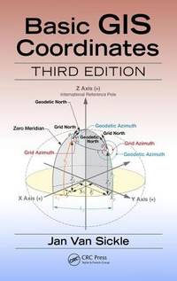
Basic GIS Coordinates Hardback - 2017 - 3rd Edition

by Van Sickle, Jan

Add to wish list
  • Used
Used - Very good

Description

CRC Press LLC. Used - Very Good. Pages intact with possible writing/highlighting. Binding strong with minor wear. Dust jackets/supplements may not be included. Stock photo provided. Product includes identifying sticker. Better World Books: Buy Books. Do Good.
Ask the seller a question Add to wish list
A$86.57
Free Delivery within USA
Standard delivery: 4 to 8 days
More delivery options
Ships from Better World Books (Indiana, United States)

Details

  • Title Basic GIS Coordinates
  • Author Van Sickle, Jan
  • Binding Hardback
  • Edition number 3rd
  • Edition 3
  • Condition Used - Very good
  • Pages 208
  • Volumes 1
  • Language ENG
  • Publisher CRC Press LLC
  • Publication date 2017
  • Illustrated Yes
  • Features Bibliography, Illustrated, Index
  • Bookseller's Inventory # 54710973-6
  • ISBN 9781498774628 / 1498774628
  • Weight 1.2 lbs (0.54 kg)
  • Dimensions 9.3 x 6.2 x 0.6 in (23.62 x 15.75 x 1.52 cm)
  • Category Technology & Industrial Arts
  • Library of Congress subjects Geographic information systems, Grids (Cartography) - Data processing
  • Library of Congress Catalogue Number 2016059466
  • Dewey Decimal Code 910.285
  • Quantity available 3

About Better World Books Indiana, United States

Biblio member since 2005

Better World Books is a for-profit, socially conscious business and a global online bookseller that collects and sells new and used books online, matching each purchase with a book donation. Each sale generates funds for literacy and education initiatives in the U.S., the UK, and around the world. Since its launch in 2003, Better World Books has raised over $35 million for libraries and literacy, donated over 38 million books, and reused or recycled more than 475 million books.

Terms of Sale: Better World Books ("BWB") values your satisfaction and offers you returns within thirty (30) days after the estimated delivery date on most items. All returned items must be in the original condition; used items should include the SKU sticker located on the spine or back of the product. If you have an incomplete, incorrect, or damaged shipment, please contact our Customer Care team via Biblio's contact seller options before proceeding with the return. Please keep in mind that because we deal mostly in used books, any extra components, such as CDs, DVDs, figurines, or access codes are not included.

Browse books from Better World Books

Reader reviews for Basic GIS Coordinates

From the publisher

Coordinates are integral building tools for GIS, cartography, surveying and are vital to the many applications we use today such as smart phones, car navigation systems and driverless cars. Basic GIS Coordinates, Third Edition grants readers with a solid understanding of coordinates and coordinate systems and how they operate as well as valuable insight into what causes them to malfunction. This practical and comprehensive guide lays out the foundation of a coordinate system and the implications behind building it as it elaborates on heights, two coordinate systems, and the rectangular system.The previous editions described horizontal and vertical datums such as the North American Datum 1983 (NAD 83) and the North American Vertical Datum 1988 (NAVD 88). Both will be replaced in 2022 or thereabouts. The National Geodetic Survey (NGS) plans to replace NAD83 with a new semi-dynamic terrestrial reference frame for North America and a new vertical datum will replace NAVD88. The foundation of the new vertical datum will be a temporally tracked gravimetric geoid. The interim period is intended to smooth the transition to the new paradigm and this new edition explores the changes and provides assistance in understanding them.

About the author

Jan Van Sickle has many years of experience in GIS, GPS, surveying, mapping, and imagery. He began working with GPS in the early 1980s when he supervised control work using the Macrometer, the first commercial GPS receiver. He created and led the GIS department at Qwest Communications, Denver, Colorado, for the company's 25,000-mile worldwide fiber optic network. He also led the team that built the GIS for natural gas gathering in the Barnett Shale. He has led nationwide seminars based on his three books: GPS for Land Surveyors, Basic GIS Coordinates, and Surveying Solved Problems. He led the team that collected, processed, and reported control positions for more than 120 cities around the world for the ortho-rectification of satellite imagery now utilized in a global web utility. He managed the creation of the worldwide T&E sites for two major earth observation satellites that are used for frequent accuracy assessments. He created an imagery-based system of deriving road centerlines that meet the stringent Advanced Driver Assistance specifications and developed a method of forest inventory to help quantify that depleted resource in Armenia. He assisted the supervision of the first GPS survey of the Grand Canyon for the photogrammetric evaluation of sandbar erosion along the Colorado River. He has performed three-dimensional mapping with terrestrial photogrammetry and LiDAR as well as Building Information Modeling for major buildings in Washington, DC. He was a member of the team of authors for the Geospatial Technology Competency Model for the Department of Labor.

tracking-