
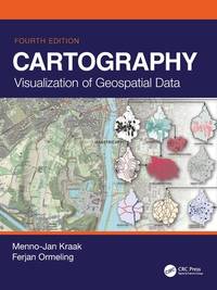
Stock photo: cover may vary
CARTOGRAPHY: VISUALIZATION OF GEOSPATIAL DATA, FOURTH EDITION Paperback - 2023
by Ferjan Ormeling
- New
A$211.33
A$21.66
Delivery to USA
Standard delivery: 20 to 30 days
More delivery options
Standard delivery: 20 to 30 days
Ships from Sanctum Books (Delhi, India)
Details
- Title CARTOGRAPHY: VISUALIZATION OF GEOSPATIAL DATA, FOURTH EDITION
- Author Ferjan Ormeling
- Binding Paperback
- Condition New
- Pages 245
- Volumes 1
- Language ENG
- Publisher CRC Press
- Publication date 2023-09-25
- Illustrated Yes
- Features Illustrated
- Bookseller's Inventory # BWP-9780367507749
- ISBN 9780367507749 / 0367507749
- Weight 1.32 lbs (0.60 kg)
- Dimensions 11 x 8.25 x 0.55 in (27.94 x 20.96 x 1.40 cm)
- Category Science
- Dewey Decimal Code 526.028
- Quantity available 500
About Sanctum Books Delhi, India
Specialising in: Art, Archaeology, Art History, And Architecture, Dictionaries And Encyclopaedias, Indian History, Languages, Literature, And Linguistics, Music, Dance, Theatre, And Cinema, Numismatics, Philately, And Epigraphy, Philosophy & Philosophy Of Science, Religion (Buddhism, Jainism, Hinduism, Sikhism, And Islam)
Biblio member since 2010
We are leading publishers, booksellers, distributors, importers, and exporters. We carry a large selection of books on varied subjects. Do place your valued order or let us know your requirement via email.
30 day return guarantee, with full refund including shipping costs for up to 30 days after delivery if an item arrives misdescribed or damaged.
�
Books are shipped by Registered Air Mail or DHL/FedEx/Aramex. Additional shipping charges may be required for multi-volume sets.
Reader reviews for CARTOGRAPHY: VISUALIZATION OF GEOSPATIAL DATA, FOURTH EDITION
Write a review for this book
Important Terms and Guidelines
- Please focus on the book’s content and context. Also, add any personal comments as to how you enjoyed the book. Substantiate your likes and dislikes. You may make comparisons to other books.
- Reviews must be at least 140 characters in length.
- Please do not reveal critical plot elements.
- This is not a help line. Contact customer support if you need help.
Your review must not include:
- Obscenities, discriminatory language, or other insulting language not suitable for public domain
- Advertisements, “spam” content, or references to other products, offers or websites.
- Email addresses, URLs, phone numbers, physical addresses or other contact information.
- Overly critical comments about other reviews or reviewers
- Time-sensitive material (i.e. promotional tours, seminars, lectures, etc.)
- Availability, price, or alternative ordering/shipping information

