
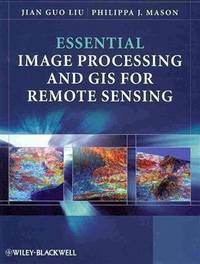
Stock photo: cover may vary
Essential Image Processing and GIS for Remote Sensing Paperback - 2009 - 1st Edition
by Liu, J. G. and Mason, P. J
- Used
- Paperback
A$20.17
A$27.04
Delivery to USA
Standard delivery: 7 to 20 days
More delivery options
Standard delivery: 7 to 20 days
Ships from Anybook.com (Lincolnshire, United Kingdom)
Details
- Title Essential Image Processing and GIS for Remote Sensing
- Author Liu, J. G. and Mason, P. J
- Binding Paperback
- Edition number 1st
- Edition 1
- Pages 464
- Volumes 1
- Language ENG
- Publisher Wiley-Blackwell, Chichester, West Sussex, England
- Publication date 2009
- Illustrated Yes
- Features Bibliography, Illustrated, Index, Maps, Table of Contents, Textbook
- Bookseller's Inventory # 8857424
- ISBN 9780470510315 / 0470510315
- Weight 2.4 lbs (1.09 kg)
- Dimensions 9.6 x 7.4 x 1 in (24.38 x 18.80 x 2.54 cm)
- Category Technology & Industrial Arts
- Library of Congress subjects Image processing, Remote sensing
- Library of Congress Catalogue Number 2009007663
- Dewey Decimal Code 621.367
About Anybook.com Lincolnshire, United Kingdom
Biblio member since 2004
Established in 1998 Anybook.com. has sold millions of scholastic books to university libraries, academics, students and reflective bibliophiles throughout the world. As the majority of our books are ex-library they are well bound, in good, clean condition and ideally suited for study and research. Our books cover a huge range of academic disciplines from Mathematics, Science and Philosophy to Art and Literature as well as many works in other European languages.
Based in central Lincoln, Anybook.com. sells exclusively online. We specialise in academic works. All our books are in good condition or better, unless otherwise described. All the books we have on sale are to hand in our warehouses in Lincoln. Photographs and additional information on request. Books out within 1 working day. We use reputable couriers at greatly discounted postage rates. As well as Visa and Mastercard, we also accept Switch, Discover and Solo. We also accept Paypal (www.paypal.com) payments. Other methods of payment are possible but please email us for details. Remember if you are unsatisfied in any way with any purchase, we will give you a complete and unconditional refund. E-mail us if you have any questions about the service we offer. Please be aware our prices and shipping costs do not include local import taxes which may need to be paid by the customer upon receipt.
Reader reviews for Essential Image Processing and GIS for Remote Sensing
Write a review for this book
Important Terms and Guidelines
- Please focus on the book’s content and context. Also, add any personal comments as to how you enjoyed the book. Substantiate your likes and dislikes. You may make comparisons to other books.
- Reviews must be at least 140 characters in length.
- Please do not reveal critical plot elements.
- This is not a help line. Contact customer support if you need help.
Your review must not include:
- Obscenities, discriminatory language, or other insulting language not suitable for public domain
- Advertisements, “spam” content, or references to other products, offers or websites.
- Email addresses, URLs, phone numbers, physical addresses or other contact information.
- Overly critical comments about other reviews or reviewers
- Time-sensitive material (i.e. promotional tours, seminars, lectures, etc.)
- Availability, price, or alternative ordering/shipping information

