
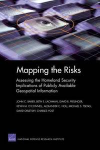
Stock photo: cover may vary
Mapping the Risks: Assessing the Homeland Security Implications of Publicly Available Geospatial Information Paperback - 2004
by Frelinger, David R
- Used
- Good
- Paperback
A$36.90
Free Delivery within USA
Standard delivery: 7 to 14 days
More delivery options
Standard delivery: 7 to 14 days
Dropship order
Ships from Bonita (California, United States)
Details
- Title Mapping the Risks: Assessing the Homeland Security Implications of Publicly Available Geospatial Information
- Author Frelinger, David R
- Binding Paperback
- Condition Used - Good
- Pages 219
- Volumes 1
- Language ENG
- Publisher RAND Corporation
- Publication date 2004-03-19
- Bookseller's Inventory # 0833035479.G
- ISBN 9780833035479 / 0833035479
- Weight 0.72 lbs (0.33 kg)
- Dimensions 9 x 6.22 x 0.52 in (22.86 x 15.80 x 1.32 cm)
- Reading level 1710
- Category Transportation
- Library of Congress Catalogue Number 2003027797
- Dewey Decimal Code 363.347
- Quantity available 1
About Bonita California, United States
Reader reviews for Mapping the Risks: Assessing the Homeland Security Implications of Publicly Available Geospatial Information
Write a review for this book
Important Terms and Guidelines
- Please focus on the book’s content and context. Also, add any personal comments as to how you enjoyed the book. Substantiate your likes and dislikes. You may make comparisons to other books.
- Reviews must be at least 140 characters in length.
- Please do not reveal critical plot elements.
- This is not a help line. Contact customer support if you need help.
Your review must not include:
- Obscenities, discriminatory language, or other insulting language not suitable for public domain
- Advertisements, “spam” content, or references to other products, offers or websites.
- Email addresses, URLs, phone numbers, physical addresses or other contact information.
- Overly critical comments about other reviews or reviewers
- Time-sensitive material (i.e. promotional tours, seminars, lectures, etc.)
- Availability, price, or alternative ordering/shipping information
From the publisher
First line
Since the September 11, 2001 terrorist attacks on the U.S. homeland, federal government agencies have withdrawn some data and information that was publicly available before the attacks.

