Description:
Pitt, Moses and Swart, Stephaman. Duynckercke, [Dunkirk]. Ca 1683. Hand coloured, copper engraved sea-chart. Chart size 440 x 505 mm, sheet size 580mm x 690mm. Two charts on one sheet showing the Dunkirk approaches. The larger chart from that of Blaeu's Pourtraict de la fameuse ville et havre de Duynckercke. With Rhumb lines, compass rose and scales. Townships and sandbanks indicated. Decorated with fleets of galleons off shore. With an inset panorama of Duynckercke [Dunkirk] after Jan Van Loon and a smaller coastal profile of Cales. The smaller chart showing the coast of Flanders, from Walchren [ Walcheren ] to Boloigne. Early hand coloured charts with later red ruled border on wide blank margins. Small tear without loss to lower blank margin, otherwise in bright and clean condition. Rare and attractive Sea Charts.
A Representation of the Solar System with the Comparative Sizes of the Planets by Salmon, Thomas - 1772
by Salmon, Thomas

A Representation of the Solar System with the Comparative Sizes of the Planets
by Salmon, Thomas
- Used
"A Representation of the Solar System with the comparative Sizes of the Planets" by Thomas Salmon c1772. 250 x 170 mm. From the 12th Edition of "A new geological and historical grammar..." published in London 1772.
This is a very nice 18th century astronomy illustration suitable for display. Some minor foxing and light discoloration along the edges. Illustrations and text are clear and legible. Intact. Excellent copy of this illustration of the contemporary understanding of the Solar System at that time.
-
Seller
Independent bookstores
 (US)
(US)
- Book Condition Used
- Quantity Available 1
- Place of Publication London
- Date Published 1772
- Size 250mm x 170mm
![Sea Chart. Duynckercke [Dunkirk].](https://d3525k1ryd2155.cloudfront.net/h/721/019/192019721.0.m.jpg)
Sea Chart. Duynckercke [Dunkirk].: Original Antique Hand coloured, copper engraved sea-chart.
by Pitt, Moses and Swart, Stephaman
- Used
- very good
- first
- Condition
- Used - Very Good
- Quantity Available
- 1
- Seller
-
Plymouth, Devon, United Kingdom
- Item Price
-
A$384.08
Show Details
Item Price
A$384.08
![Blatt 8 (VIII) : Aarau - Luzern Zug - Zürich [Zurich] : Topographische Karte der Schweiz :...](https://d3525k1ryd2155.cloudfront.net/h/777/796/330796777.0.m.jpg)
More Photos
Blatt 8 (VIII) : Aarau - Luzern Zug - Zürich [Zurich] : Topographische Karte der Schweiz : Massstab 1 : 100,000, Vermessen und herausgegeben unter Aufsicht von General G. H. Dufour
by Dufour, General G. H. [Guillaume-Henri]
- Used
- Hardcover
- Condition
- Used - Very Good (somewhat spotted)
- Edition
- 1861 edition
- Binding
- Hardcover
- Quantity Available
- 1
- Seller
-
Henderson, Nevada, United States
- Item Price
-
A$268.31
Show Details
Description:
Bern [Switzerland]: Hans Körber [Koerber] (Huber & Comp.), 1861. Very Good condition. SEE PHOTOS. Karten etwas fleckig (maps somewhat spotted). This is Blatt VIII, Aarau - Luzern Zug - Zürich [Zurich]. The map is dated 1861 and has 21 sections. It is printed on paper, then mounted on cloth (i.e. backed with linen). When folded the map measures 19 cm tall x 11 cm wide. When unfolded, 57 cm tall x 79 cm wide. SEE PHOTOS. Linen-backed, steel-engraved folding map in 21 segments. Scale 1:100,000.. 1861 edition. Hardcover. Very Good (somewhat spotted).
Item Price
A$268.31

More Photos
Portrait and Biographical Album of WILL COUNTY, ILLINOIS containing Full Page Portraits and Biographical Sketches of Prominent and Representative Citizens of the County 1890: 19th Century Geneology
by Chapman Brothers
- Used
- Hardcover
- first
- Condition
- Used - Good-
- Jacket Condition
- none
- Edition
- Later printing of the 1st edition, copyright 1885 Chapman
- Binding
- Hardcover
- Quantity Available
- 1
- Seller
-
Winfield, Illinois, United States
- Item Price
-
A$383.30
Show Details
Description:
Book is in Very Good condition but the leather cover is fragile/Fair. All around gilt, spine is very worn and the hinges are cracked with the covers almost detached. 771 pages plus transportation. Also includes portraits and biographies of all the presidents of the U.S. and Governors of the State. A very large book, additional shipping outside the continental U.S.A.
Item Price
A$383.30
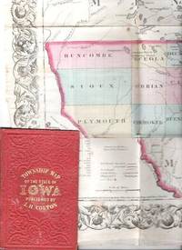
COLTON'S TOWNSHIP MAP OF THE STATE OF IOWA: Compiled from the United Statees Surveys & other Authentic Sources.; Drawn by George W. Colton. Engraved by J.M. Atwood
by Iowa
- Used
- good
- Condition
- Used - Good
- Edition
- 1855 edition
- Binding
- Unknown
- Quantity Available
- 1
- Seller
-
Roosevelt, New Jersey, United States
- Item Price
-
A$459.96
Show Details
Description:
New York: J.H. Colton & Co, 1855. 1855 edition. Original Cloth. Good. Full-color engraved map, colored by hand, scrollwork border on all sides, opens to 25" x 29"; repairable separations at the intersections of several folds. Folds into red cloth case with embossed all-over design on both covers, gilt lettering on front. 5.5" x 3.75" [OCLC locates three holdings of this edition: Grinnell Col, U Iowa, Stanford U. Decker 23:225--1870 edition.].
Item Price
A$459.96

More Photos
SMITH'S MAP OF PHILADELPHIA AND VICINITY
by Gannett, Henry; Chief Topographer, U. S. Geological Survey
- Used
- Hardcover
- first
- Condition
- Used - Good+
- Edition
- First Edition Thus; Second Printing
- Binding
- Hardcover
- Quantity Available
- 1
- Seller
-
Fairfield, New Jersey, United States
- Item Price
-
A$268.31
Show Details
Description:
Philadelphia: J. L. Smith. Good+. 1904. First Edition Thus; Second Printing. Hardcover. U. S. Geological Survey, surveyed in 1894, edition of 1902, printed in 1904. This is a 30 1/2" x 38 1/2" USGS map that J. L. Smith of Philadelphia, sometime after issue, sectioned (4 sections x 6 sections) and mounted on linen to create a folding pocket map. It is mounted in a 10 x 5.5 inch dark brown embossed and gilded hardcover folder that bears the title "Smith's Map of Philadelphia and Vicinity". The map covers the area north and west well past Norristown and south into Delaware, as well as a good part of New Jersey beyond Camden. It shows the local road network and was made for local travel. The inside cover has original owner's signature. Cover graded G+ due to rubbing along the spine edges & corners. The map is in VG condition. ; Fold out cloth Map; Small 4to 9" - 11" tall .
Item Price
A$268.31
Sea Chart. Duynckercke [Dunkirk].: Original Antique Hand coloured, copper engraved sea-chart.
by Pitt, Moses and Swart, Stephaman
- Used
- very good
- first
- Condition
- Used - Very Good
- Quantity Available
- 1
- Seller
-
Plymouth, Devon, United Kingdom
- Item Price
-
A$384.08
Show Details
Description:
Pitt, Moses and Swart, Stephaman. Duynckercke, [Dunkirk]. Ca 1683. Hand coloured, copper engraved sea-chart. Chart size 440 x 505 mm, sheet size 580mm x 690mm. Two charts on one sheet showing the Dunkirk approaches. The larger chart from that of Blaeu's Pourtraict de la fameuse ville et havre de Duynckercke. With Rhumb lines, compass rose and scales. Townships and sandbanks indicated. Decorated with fleets of galleons off shore. With an inset panorama of Duynckercke [Dunkirk] after Jan Van Loon and a smaller coastal profile of Cales. The smaller chart showing the coast of Flanders, from Walchren [ Walcheren ] to Boloigne. Early hand coloured charts with later red ruled border on wide blank margins. Small tear without loss to lower blank margin, otherwise in bright and clean condition. Rare and attractive Sea Charts.
Item Price
A$384.08
More Photos
Blatt 8 (VIII) : Aarau - Luzern Zug - Zürich [Zurich] : Topographische Karte der Schweiz : Massstab 1 : 100,000, Vermessen und herausgegeben unter Aufsicht von General G. H. Dufour
by Dufour, General G. H. [Guillaume-Henri]
- Used
- Hardcover
- Condition
- Used - Very Good (somewhat spotted)
- Edition
- 1861 edition
- Binding
- Hardcover
- Quantity Available
- 1
- Seller
-
Henderson, Nevada, United States
- Item Price
-
A$268.31
Show Details
Description:
Bern [Switzerland]: Hans Körber [Koerber] (Huber & Comp.), 1861. Very Good condition. SEE PHOTOS. Karten etwas fleckig (maps somewhat spotted). This is Blatt VIII, Aarau - Luzern Zug - Zürich [Zurich]. The map is dated 1861 and has 21 sections. It is printed on paper, then mounted on cloth (i.e. backed with linen). When folded the map measures 19 cm tall x 11 cm wide. When unfolded, 57 cm tall x 79 cm wide. SEE PHOTOS. Linen-backed, steel-engraved folding map in 21 segments. Scale 1:100,000.. 1861 edition. Hardcover. Very Good (somewhat spotted).
Item Price
A$268.31
More Photos
Portrait and Biographical Album of WILL COUNTY, ILLINOIS containing Full Page Portraits and Biographical Sketches of Prominent and Representative Citizens of the County 1890: 19th Century Geneology
by Chapman Brothers
- Used
- Hardcover
- first
- Condition
- Used - Good-
- Jacket Condition
- none
- Edition
- Later printing of the 1st edition, copyright 1885 Chapman
- Binding
- Hardcover
- Quantity Available
- 1
- Seller
-
Winfield, Illinois, United States
- Item Price
-
A$383.30
Show Details
Description:
Book is in Very Good condition but the leather cover is fragile/Fair. All around gilt, spine is very worn and the hinges are cracked with the covers almost detached. 771 pages plus transportation. Also includes portraits and biographies of all the presidents of the U.S. and Governors of the State. A very large book, additional shipping outside the continental U.S.A.
Item Price
A$383.30
COLTON'S TOWNSHIP MAP OF THE STATE OF IOWA: Compiled from the United Statees Surveys & other Authentic Sources.; Drawn by George W. Colton. Engraved by J.M. Atwood
by Iowa
- Used
- good
- Condition
- Used - Good
- Edition
- 1855 edition
- Binding
- Unknown
- Quantity Available
- 1
- Seller
-
Roosevelt, New Jersey, United States
- Item Price
-
A$459.96
Show Details
Description:
New York: J.H. Colton & Co, 1855. 1855 edition. Original Cloth. Good. Full-color engraved map, colored by hand, scrollwork border on all sides, opens to 25" x 29"; repairable separations at the intersections of several folds. Folds into red cloth case with embossed all-over design on both covers, gilt lettering on front. 5.5" x 3.75" [OCLC locates three holdings of this edition: Grinnell Col, U Iowa, Stanford U. Decker 23:225--1870 edition.].
Item Price
A$459.96
More Photos
SMITH'S MAP OF PHILADELPHIA AND VICINITY
by Gannett, Henry; Chief Topographer, U. S. Geological Survey
- Used
- Hardcover
- first
- Condition
- Used - Good+
- Edition
- First Edition Thus; Second Printing
- Binding
- Hardcover
- Quantity Available
- 1
- Seller
-
Fairfield, New Jersey, United States
- Item Price
-
A$268.31
Show Details
Description:
Philadelphia: J. L. Smith. Good+. 1904. First Edition Thus; Second Printing. Hardcover. U. S. Geological Survey, surveyed in 1894, edition of 1902, printed in 1904. This is a 30 1/2" x 38 1/2" USGS map that J. L. Smith of Philadelphia, sometime after issue, sectioned (4 sections x 6 sections) and mounted on linen to create a folding pocket map. It is mounted in a 10 x 5.5 inch dark brown embossed and gilded hardcover folder that bears the title "Smith's Map of Philadelphia and Vicinity". The map covers the area north and west well past Norristown and south into Delaware, as well as a good part of New Jersey beyond Camden. It shows the local road network and was made for local travel. The inside cover has original owner's signature. Cover graded G+ due to rubbing along the spine edges & corners. The map is in VG condition. ; Fold out cloth Map; Small 4to 9" - 11" tall .
Item Price
A$268.31

Stock Photo: Cover May Be Different
How to Build a Beowulf: A Guide to the Implementation and Application of PC Clusters (Scientific and Engineering Computation)
by Savarese, Daniel F.; Becker, Donald J.; Salmon, John; Sterling, Thomas
- Used
- good
- Paperback
- Condition
- Used - Good
- Binding
- Paperback
- ISBN 10 / ISBN 13
- 9780262692182 / 026269218X
- Quantity Available
- 1
- Seller
-
Memphis, Tennessee, United States
- Item Price
-
A$8.39
Show Details
Description:
MIT Press, 1999-05-28. Paperback. Good. 9x7x0.
Item Price
A$8.39

How to Build a Beowulf : A Guide to the Implementation and Application of PC Clusters
by Donald J. Becker; William Gropp; Daniel F. Savarese; Thomas L. Sterling; John Salmon
- Used
- good
- Paperback
- Condition
- Used - Good
- Binding
- Paperback
- ISBN 10 / ISBN 13
- 9780262692182 / 026269218X
- Quantity Available
- 2
- Seller
-
Seattle, Washington, United States
- Item Price
-
A$9.18
Show Details
Description:
MIT Press, 1999. Paperback. Good. Pages can have notes/highlighting. Spine may show signs of wear. ~ ThriftBooks: Read More, Spend Less.Dust jacket quality is not guaranteed.
Item Price
A$9.18
Stock Photo: Cover May Be Different
How to Build a Beowulf: A Guide to the Implementation and Application of PC Clusters (Scientific and Engineering Computation)
by Savarese, Daniel F.,Becker, Donald J.,Salmon, John,Sterling, Thomas
- Used
- very good
- Paperback
- Condition
- Used - Very Good
- Binding
- Paperback
- ISBN 10 / ISBN 13
- 9780262692182 / 026269218x
- Quantity Available
- 1
- Seller
-
Simi Valley, California, United States
- Item Price
-
A$3.07
Show Details
Description:
The MIT Press, 5/28/1999 12:00:01 A. paperback. Very Good. 0.7000 8.9000 7.9000.
Item Price
A$3.07

Stock Photo: Cover May Be Different
Mental Diseases: A Public Health Problem
by James Vance May; Foreword-Thomas W. Salmon
- Used
- good
- Paperback
- Condition
- Used - Good
- Binding
- Paperback
- ISBN 10 / ISBN 13
- 9781432509989 / 1432509985
- Quantity Available
- 1
- Seller
-
HOUSTON, Texas, United States
- Item Price
-
A$10.41
Show Details
Description:
Kessinger Publishing, LLC, 2007-01-17. Paperback. Good.
Item Price
A$10.41
Stock Photo: Cover May Be Different
How to Build a Beowulf : A Guide to the Implementation and Application of PC Clusters
by Salmon, John, Gropp, William, Savarese, Daniel F., Sterling, Thomas L., Becker, Donald J
- Used
- Condition
- Used - Very Good
- ISBN 10 / ISBN 13
- 9780262692182 / 026269218x
- Quantity Available
- 1
- Seller
-
Mishawaka, Indiana, United States
- Item Price
-
A$10.55
Show Details
Description:
MIT Press. Used - Very Good. Former library book; may include library markings. Used book that is in excellent condition. May show signs of wear or have minor defects.
Item Price
A$10.55
Stock Photo: Cover May Be Different
How to Build a Beowulf : A Guide to the Implementation and Application of PC Clusters
by Salmon, John, Gropp, William, Savarese, Daniel F., Sterling, Thomas L., Becker, Donald J
- Used
- Condition
- Used - Good
- ISBN 10 / ISBN 13
- 9780262692182 / 026269218x
- Quantity Available
- 1
- Seller
-
Mishawaka, Indiana, United States
- Item Price
-
A$10.55
Show Details
Description:
MIT Press. Used - Good. Used book that is in clean, average condition without any missing pages.
Item Price
A$10.55
Stock Photo: Cover May Be Different
How to Build a Beowulf : A Guide to the Implementation and Application of PC Clusters
by Salmon, John, Gropp, William, Savarese, Daniel F., Sterling, Thomas L., Becker, Donald J
- Used
- Condition
- Used - Very Good
- ISBN 10 / ISBN 13
- 9780262692182 / 026269218x
- Quantity Available
- 1
- Seller
-
Mishawaka, Indiana, United States
- Item Price
-
A$10.55
Show Details
Description:
MIT Press. Used - Very Good. Used book that is in excellent condition. May show signs of wear or have minor defects.
Item Price
A$10.55
Stock Photo: Cover May Be Different
How to Build a Beowulf: A Guide to the Implementation and Application of PC Clusters (Scientific and Engineering Computation)
by Thomas Sterling; Daniel F. Savarese; Donald J. Becker; John Salmon
- Used
- Paperback
- Condition
- Used: Good
- Binding
- Paperback
- ISBN 10 / ISBN 13
- 9780262692182 / 026269218X
- Quantity Available
- 1
- Seller
-
HOUSTON, Texas, United States
- Item Price
-
A$11.47
Show Details
Description:
The MIT Press, 1999-05-28. Paperback. Used: Good.
Item Price
A$11.47
Stock Photo: Cover May Be Different
Mental Diseases: A Public Health Problem
by James Vance May, Thomas W. Salmon (Foreword)
- Used
- Paperback
- Condition
- Used:Good
- Binding
- Paperback
- ISBN 10 / ISBN 13
- 9781432509989 / 1432509985
- Quantity Available
- 1
- Seller
-
HOUSTON, Texas, United States
- Item Price
-
A$13.02
Show Details
Description:
Kessinger Publishing, LLC, 2007-01-17. Paperback. Used:Good.
Item Price
A$13.02
Stock Photo: Cover May Be Different
How to Build a Beowulf: A Guide to the Implementation and Application of PC Clusters (Scientific and Engineering Computation)
by Savarese, Daniel F., Becker, Donald J., Salmon, John, Sterling, Thomas
- Used
- Condition
- Used - Good
- ISBN 10 / ISBN 13
- 9780262692182 / 026269218x
- Quantity Available
- 1
- Seller
-
Frederick, Maryland, United States
- Item Price
-
A$8.28
Show Details
Description:
The MIT Press. Used - Good. Good condition. A copy that has been read but remains intact. May contain markings such as bookplates, stamps, limited notes and highlighting, or a few light stains.
Item Price
A$8.28

More Photos
The Sky and the Forest
by Forester, C.S
- Used
- very good
- Hardcover
- first
- Condition
- Used - Very Good
- Jacket Condition
- Very Good
- Edition
- First Edition
- Binding
- Hardcover
- Quantity Available
- 1
- Seller
-
Salem, Oregon, United States
- Item Price
-
A$53.49A$26.75Save A$17.44!
Show Details
Description:
C.S. Forester: The Sky and the Forest. Little, Brown and Company, Boston. Stated First Edition First Printing Thus August, 1948. Cover price $2.75. Used. VG BOOK/VG UNCLIPPED DUST JACKET. A story of a central Africa. By C.S. Forester, author of the Admiral Hornblower series.
Item Price
A$53.49A$26.75
Save A$17.44
!

More Photos
Plat Book: Pierce County, Wisconsin
by Rhame, A. E
- Used
- Fine
- Paperback
- Condition
- Used - Fine
- Binding
- Paperback
- Quantity Available
- 1
- Seller
-
Woodruff, Wisconsin, United States
- Item Price
-
A$71.54
Show Details
Description:
1930. Soft Cover. Fine. Unpaginated. Tan colored book is in Fine condition, no sign of wear.
Item Price
A$71.54
![Alaska and Klondike Region; [With inset of Klondike Region on the Upper Yukon detail] [From an...](https://d3525k1ryd2155.cloudfront.net/h/062/537/1339537062.0.m.jpg)
Alaska and Klondike Region; [With inset of Klondike Region on the Upper Yukon detail] [From an atlas, "Gazetteer of Alaska and Yukon Region " pp. 105 and 106]
by Miller, J. Martin
- Used
- very good
- Condition
- Used - Very Good
- Edition
- Unknown
- Quantity Available
- 1
- Seller
-
Sebastopol, California, United States
- Item Price
-
A$59.79
Show Details
Description:
Chicago: J. Martin Miller, 1899. Unknown. Map. Very Good. [Map copyright 1899, printing date of Atlas later] [19.875x15.125in]; Colored map of Alaska with steamer routes from Portland and Seattle, insets of the Klondike Region on the Upper Yukon and Western portion of Aleutian Islands; On verso index of places and names with two large black and white images; Age toning to all edges, water stain marks on bottom, slight printing offset of colors, small chips and closed tears to lower edge;.
Item Price
A$59.79

Zemepis Sveta - Monsunova Asie
by De La Blache, P. Vidal; Gallois, L
- Used
- Hardcover
- Condition
- Used - Very Good Condition
- Jacket Condition
- No Dust Jacket
- Binding
- Hardcover
- Quantity Available
- 1
- Seller
-
Oak Point, Texas, United States
- Item Price
-
A$91.99
Show Details
Description:
Aventinum, Prague, Czechoslovakia, 1930. Hardcover. Very Good Condition/No Dust Jacket. Text entirely in Czech. Geography book on Asia with numerous photographs and maps. 1931 edition also available. Size: 4mo - over 9 3/4" - 12" tall. 400 pp. Pages are yellowed, but are tight and clean. Moderate shelfwear along the spine. Corners are lightly bumped. Quantity Available: 1. Shipped Weight: 3-5 pounds. Category: Travel & Places; Non-English Language::Czech; Pictures of this item not already displayed here available upon request. Inventory No: 001227. . Additional shipping charges may apply.
Item Price
A$91.99

Zemepis Sveta - Monsunova Asie
by De La Blache, P. Vidal; Gallois, L
- Used
- Hardcover
- Condition
- Used - Very Good Condition
- Jacket Condition
- No Dust Jacket
- Binding
- Hardcover
- Quantity Available
- 1
- Seller
-
Oak Point, Texas, United States
- Item Price
-
A$91.99
Show Details
Description:
Aventinum, Prague, Czechoslovakia, 1931. Hardcover. Very Good Condition/No Dust Jacket. Text entirely in Czech. Geography book on Asia with numerous photographs and maps. 1930 edition also available. Size: 4mo - over 9 3/4" - 12" tall. 400 pp. Pages are yellowed, but are tight and clean. Moderate shelfwear along the spine. Corners are lightly bumped. Quantity Available: 1. Shipped Weight: 3-5 pounds. Category: Travel & Places; Non-English Language::Czech; Pictures of this item not already displayed here available upon request. Inventory No: 001228. . Additional shipping charges may apply.
Item Price
A$91.99

Last Tales
by Dinesen, Isak
- Used
- very good
- Hardcover
- first
- Condition
- Used - Very Good
- Jacket Condition
- Good+
- Edition
- First Edition
- Binding
- Hardcover
- Quantity Available
- 1
- Seller
-
Salem, Oregon, United States
- Item Price
-
A$183.98A$91.99Save A$60.00!
Show Details
Description:
Dinesen, Isak: Last Tales, A Collection of Twelve New Tales of Compelling Beauty 1957, Random House. First Edition. Stated First Printing Thus. Used. Very Good/Good+ original red dust jacket, price-clipped. Jacket states 11/57 on front flap. 5 3/4 X
Item Price
A$183.98A$91.99
Save A$60.00
!

The Adventure of Wrangel Island
by Vilhjalmur Stefansson
- Used
- good
- Hardcover
- first
- Condition
- Used - Good
- Jacket Condition
- No DJ Included
- Edition
- First Edition
- Binding
- Hardcover
- Quantity Available
- 1
- Seller
-
Salem, Oregon, United States
- Item Price
-
A$191.48A$95.75Save A$62.44!
Show Details
Description:
The Adventure of Wrangel Island, Alaska (1925 Macmillan 1st Edition) HISTORY OF ALASKA. EXLIB. Good Condition/ No DJ included. Fold-out map affixed to binding at the back of the book has never been opened. The story of the (unsuccessful) attempted colonization of Wrangel Island Alaska. 413 pages plus appendix, Index. Titling is still bright. A clean, solid copy. Scarce.
Item Price
A$191.48A$95.75
Save A$62.44
!

Seven Pillars Of Wisdom, A Triumph
by Lawrence, T.E
- Used
- good
- Hardcover
- first
- Condition
- Used - Good
- Jacket Condition
- No DJ Included
- Edition
- First American Edition
- Binding
- Hardcover
- Quantity Available
- 1
- Seller
-
Salem, Oregon, United States
- Item Price
-
A$191.57A$95.79Save A$62.47!
Show Details
Description:
T.E. Lawrence. SEVEN PILLARS OF WISDOM, A TRIUMPH. AUTOBIOGRAPHY. Privately Printed, 1926. First Published for general circulation 1935. First American Edition. States MCMXXXVI on the title page. Doubleday, Doran & Company, Inc. Garden City, NY. GOOD CONDITION/ NO DUST JACKET IS INCLUDED. 672 pages, indexed. Beige buckram boards. Spine has darkened a bit. 6 7/8 X 9 ½.
Item Price
A$191.57A$95.79
Save A$62.47
!

Asia from the Best Authorities, Russell, ca.1800
by Russell
- Used
- Condition
- Used
- Quantity Available
- 1
- Seller
-
Plymouth, Devon, United Kingdom
- Item Price
-
A$38.41
Show Details
Description:
Russell, J. : Asia from the Best Authorities. Nd but ca.1800. From "A New Geographical, Historical and Commercial Grammar and Present State of Several Kingdoms of the World". Copper engraving. Size approx 200 x 230mm. Two neat folds. Some age colouring to edges, otherwise clean and bright. Includes Arabia, India, Borneo, Japan, China and eastern Russia.
Item Price
A$38.41

North America from the Best Authorities, Russell, ca.1800
by Russell
- Used
- Condition
- Used
- Quantity Available
- 1
- Seller
-
Plymouth, Devon, United Kingdom
- Item Price
-
A$38.41
Show Details
Description:
Russell, J. : A General Map of North America from the Best Authorities. Nd but ca.1800. From "A New Geographical, Historical and Commercial Grammar and Present State of Several Kingdoms of the World." Copper engraving. Size approx 200 x 230mm. Two neat folds. Some age colouring to edges, otherwise very clean and bright.
Item Price
A$38.41