Description:
Denver: Louthan Book Company, 1904. 1st. Paperback. Fine. With illustrations. Preface by John Coble. Bound in original pictorial wraps. Adams Six-Guns 1033. Adams Herd 1066.
Tulare County California. 1907 by H. Levinson, Visalia, Cal. Copyright 1907 - c. 1907: Compiled and Drawn by Edw. A. Combes
by H. Levinson, Visalia, Cal. Copyright 1907

Tulare County California. 1907: Compiled and Drawn by Edw. A. Combes
by H. Levinson, Visalia, Cal. Copyright 1907
- Used
Map Details and Condition:
color lithograph
color lithograph
dimensions: 24 3/4" x 19"
condition: professionally conserved and backed on Japanese tissue, original color, paper loss at original folds, some paper loss around perimeter of map sheet
Map Description:Tulare County, California is sparsely developed as shown on this scarce 1907 map of Tulare County California. drawn and compiled by Edw. A. Combes. This map includes Sequoia National Park, established in 1890 and the Tule River Indian Reserve as lands set apart and separately owned. Sequoia National Park was established under the administration of President Benjamin Harrison as the second American national Park. The National Park Service explains in its history of Sequoia National Park that it was specifically established to protect California's giant sequoia trees from industrial logging. The National Park Service had not yet been established and therefore federal protection of the territory and trees within Sequoia National Park was assigned to the U.S. Army Cavalry who were sent from San Francisco to the park from 1891 to 1913. The larger territory outside of the national park boundary is labeled "Sierra Forest Reserve". Therefore, this scarce map shows Tulare County and its unspoiled forest lands before development pressures arose from the large scale construction of roads for passenger vehicles.
The Tule River Indian Tribe of California is a federally recognized sovereign nation. The Tule River Tribe web site is an initial source of history and current status of negotiations by the Tule River Tribe to establish their legal rights to water rights in the Tule River. The Tule River Indian Reservation was established by U.S. Executive Order in 1873. The land area is 55,356 acres. One can see from the graphic representation of the Tule River Indian Reserve that the land area is a fraction of the area dedicated by U.S. Executive Order to the Sequoia National Park, and an even smaller fraction of the total land area of Tulare County. This land is shown on the 1907 map closer to its mid-19th c. state when the territory was originally watered by rivers, streams and the Tulare Lake that is not recognizable today. Subsequent dams and water diversion have reduced Tulare Lake from its original vast size exceeding the surface area of Lake Tahoe. Water rights are therefore a current issue in the wake of historic water loss and destruction of wetlands species. Please see research and comment provided in The Tribune by David Middlecamp in March, 2017.
The Tulare County Map "Reference" key shows symbols for railroads, roads, schools and five numbered supervisor districts. Trails, ditches and Irrigation Districts are also indicated on this map. Within Tulare County, districts are outlined in contrasting colors. The grid system overlaid the entire county indicates the numbered land lot system of the Public Land Survey System. Several railroads run through Tulare County. A Military Reserve is situated on the north eastern county border. Mountain heights are indicated. Abutting counties are also named. The map is framed in a simple but decorative frame.
-
Seller
Original Antique Maps
 (US)
(US)
- Book Condition Used
- Quantity Available 1
- Publisher Photo Litho. Britton & Rey S.F.
- Place of Publication Visalia, California
- Date Published c. 1907
- Keywords Tulare County, California , Britton & Rey, Sequoia National Park, Tule River Indian Tribe, California map early 20th c.

Life of Tom Horn Government Scout and Interpreter by Himself Together with His Letters and Statements by His Friends; A Vindication
by Horn, Tom
- Used
- Fine
- Paperback
- first
- Condition
- Used - Fine
- Edition
- 1st
- Binding
- Paperback
- Quantity Available
- 1
- Seller
-
Minneapolis, Minnesota, United States
- Item Price
-
A$1,395.45
Show Details
Item Price
A$1,395.45
More Photos
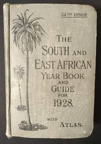
The South and East African Year Book Guide. With Atlas and Diagrams. 34th Issue owned by A. Jessop: Union-Castle Atlas pp. 2-64 with color maps, single and double page, George Philips & Son, Geographical Institute, London
by Edited Annually By A. Samler Brown, F.R.M.S. & G. Gordon Brown, F.R.G.S.
- Used
- Hardcover
- Signed
- Condition
- Used
- Edition
- 34th
- Binding
- Hardcover
- Quantity Available
- 1
- Seller
-
FRAMINGHAM, Massachusetts, United States
- Item Price
-
A$426.39
Show Details
Description:
Contents and Condition:Union-Castle Atlas pp. 2-64 with color maps, single and double page, George Philips & Son, Geographical Institute, London"Advertisements South Africa, Capetown with East Africa Route", pp. 1-129.
dimensions: 7 3/8" x 5 1/2" x 1 5/8"
condition: decorated fabric covers show mild wear, binding tight, front cover attached with weakening at bottom of binding
owner's name in manuscript ink on title page: "A.Jessop Coronado, California, U.S.A"Description:
This densely informative travel guide was owned by A. Jessop of Coronado, California. The A. Jessop who owned this book is most likely a son of Joseph Edward Jessop, an English watchmaker and jewelry store owner who with his wife emigrated from London, England to California, seeking to settle in the San Diego area with their children. The Jessop family established a jewelry store that became multi-generational in the San Diego, California area. In 1901 the Jessop family moved to Coronado, California. In 1907, Mr. Jessop… Read More
Item Price
A$426.39
More Photos
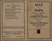
Napa County California. 1914
by Copyright 1914 by Punnett Brothers
- Used
- Condition
- Used
- Quantity Available
- 1
- Seller
-
FRAMINGHAM, Massachusetts, United States
- Item Price
-
A$1,472.98
Show Details
Description:
Map Details and Condition:color lithograph
dimensions: 26 3/4" x 19"
Brown Paper pocket covers with red bookstore label of Neal Stratford & Kerr, San Francisco
condition: professionally flattened and otherwise in as found, very good conditionDescription:
This 1914 map of now popular wine country Napa County, California shows the county in 1914, with early roads, largely undeveloped, vast open land areas, and natural features. The numbered grid system on this map reflects the Public Land Survey System. Large open tracts of land are identified as ranches, such as Rancho Catacoula, or Rancho Las Putas, Rancho LaJota all of which are large swaths of undivided land. Urban grids are shown in the southernmost part of Napa County, and sections of the southernmost sections of Sonoma County and Solano County. The cities of Petaluma, Sonoma, Vallejo and Napa and Benicia show populated urban areas. A corner of Marin County is shown.
C.F. Weber & Co. and the Punnett Brothers published… Read More
Item Price
A$1,472.98

Published by the Milwaukee Sentinel Commemorating Its One Hundredth Anniversary June 27, 1937: Approved by the Wisconsin Conservation Commission, Checked and Approved by Dr. Joseph Schafer, Superintendent of the Historical Society of Wisconsin and Dr. Louise Phelps Kellogg, Senior Research Associate Endorsed by the Wisconsin State Chamber of Commer
by Copyright 1932 by Erwin F. Bahlmann and Artist Nina S. Bahlman
- Used
- Condition
- Used
- Quantity Available
- 1
- Seller
-
FRAMINGHAM, Massachusetts, United States
- Item Price
-
A$1,007.82
Show Details
Description:
Map Details and Condition:color lithograph by Litho in U.S.A.
dimensions: 24" x 28.5 " print, 26 1/4" x 30" sheet size
condition: professionally removed from wood backing and restored, deeply toned paper, some surface damage to paper, repaired vertical tear through sheet, backed with Japanese Mulberry tissue, some chipping at edges Map Description:
This scarce Wisconsin pictorial map was created by the artist Nina S. Bahlman (b1886-___) whose art work other than this map may exist in collections but is not readily identified. The copyright is held by Erwin F. Bahlmann (b.1886-__) a family member or spouse. The Library of Congress cites its copy of this map as Historical Map of Wisconsin and cites a 1995 copyright registration. WorldCat confirms that there is a 1995 reprint of this map. A further note corrects the spelling of the artist's name to read "Bahlmann". The example of the map on offer gives every appearance of being the 1932 edition.
The map was published… Read More
Item Price
A$1,007.82
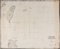
East India Archipelago Chart No. 7 (1878): Formosa
by James Imray and Son
- Used
- Condition
- Used
- Quantity Available
- 1
- Seller
-
FRAMINGHAM, Massachusetts, United States
- Item Price
-
A$1,395.45
Show Details
Description:
Chart Details:black and white engraving, navigation lights marked with red and yellow, blue backed
Blue ink stamp next to title block: "Imray & Son London 1878"
Publisher's original paper label glued to back of chart
condition: as found rolled, top left corner approx. 2" piece missing that includes some of perimeter printed border of chart, overall a clean chart with some spotting on edges, some spotting in vicinity of title block, paper toned along right vertical edge chart, edges overall in good condition, this chart was used to plot several voyages and has manuscript pencil notes with dates
Item Price
A$1,395.45
Life of Tom Horn Government Scout and Interpreter by Himself Together with His Letters and Statements by His Friends; A Vindication
by Horn, Tom
- Used
- Fine
- Paperback
- first
- Condition
- Used - Fine
- Edition
- 1st
- Binding
- Paperback
- Quantity Available
- 1
- Seller
-
Minneapolis, Minnesota, United States
- Item Price
-
A$1,395.45
Show Details
Description:
Denver: Louthan Book Company, 1904. 1st. Paperback. Fine. With illustrations. Preface by John Coble. Bound in original pictorial wraps. Adams Six-Guns 1033. Adams Herd 1066.
Item Price
A$1,395.45
More Photos
The South and East African Year Book Guide. With Atlas and Diagrams. 34th Issue owned by A. Jessop: Union-Castle Atlas pp. 2-64 with color maps, single and double page, George Philips & Son, Geographical Institute, London
by Edited Annually By A. Samler Brown, F.R.M.S. & G. Gordon Brown, F.R.G.S.
- Used
- Hardcover
- Signed
- Condition
- Used
- Edition
- 34th
- Binding
- Hardcover
- Quantity Available
- 1
- Seller
-
FRAMINGHAM, Massachusetts, United States
- Item Price
-
A$426.39
Show Details
Description:
Contents and Condition:Union-Castle Atlas pp. 2-64 with color maps, single and double page, George Philips & Son, Geographical Institute, London"Advertisements South Africa, Capetown with East Africa Route", pp. 1-129.
dimensions: 7 3/8" x 5 1/2" x 1 5/8"
condition: decorated fabric covers show mild wear, binding tight, front cover attached with weakening at bottom of binding
owner's name in manuscript ink on title page: "A.Jessop Coronado, California, U.S.A"Description:
This densely informative travel guide was owned by A. Jessop of Coronado, California. The A. Jessop who owned this book is most likely a son of Joseph Edward Jessop, an English watchmaker and jewelry store owner who with his wife emigrated from London, England to California, seeking to settle in the San Diego area with their children. The Jessop family established a jewelry store that became multi-generational in the San Diego, California area. In 1901 the Jessop family moved to Coronado, California. In 1907, Mr. Jessop… Read More
Item Price
A$426.39
More Photos
Napa County California. 1914
by Copyright 1914 by Punnett Brothers
- Used
- Condition
- Used
- Quantity Available
- 1
- Seller
-
FRAMINGHAM, Massachusetts, United States
- Item Price
-
A$1,472.98
Show Details
Description:
Map Details and Condition:color lithograph
dimensions: 26 3/4" x 19"
Brown Paper pocket covers with red bookstore label of Neal Stratford & Kerr, San Francisco
condition: professionally flattened and otherwise in as found, very good conditionDescription:
This 1914 map of now popular wine country Napa County, California shows the county in 1914, with early roads, largely undeveloped, vast open land areas, and natural features. The numbered grid system on this map reflects the Public Land Survey System. Large open tracts of land are identified as ranches, such as Rancho Catacoula, or Rancho Las Putas, Rancho LaJota all of which are large swaths of undivided land. Urban grids are shown in the southernmost part of Napa County, and sections of the southernmost sections of Sonoma County and Solano County. The cities of Petaluma, Sonoma, Vallejo and Napa and Benicia show populated urban areas. A corner of Marin County is shown.
C.F. Weber & Co. and the Punnett Brothers published… Read More
Item Price
A$1,472.98
Published by the Milwaukee Sentinel Commemorating Its One Hundredth Anniversary June 27, 1937: Approved by the Wisconsin Conservation Commission, Checked and Approved by Dr. Joseph Schafer, Superintendent of the Historical Society of Wisconsin and Dr. Louise Phelps Kellogg, Senior Research Associate Endorsed by the Wisconsin State Chamber of Commer
by Copyright 1932 by Erwin F. Bahlmann and Artist Nina S. Bahlman
- Used
- Condition
- Used
- Quantity Available
- 1
- Seller
-
FRAMINGHAM, Massachusetts, United States
- Item Price
-
A$1,007.82
Show Details
Description:
Map Details and Condition:color lithograph by Litho in U.S.A.
dimensions: 24" x 28.5 " print, 26 1/4" x 30" sheet size
condition: professionally removed from wood backing and restored, deeply toned paper, some surface damage to paper, repaired vertical tear through sheet, backed with Japanese Mulberry tissue, some chipping at edges Map Description:
This scarce Wisconsin pictorial map was created by the artist Nina S. Bahlman (b1886-___) whose art work other than this map may exist in collections but is not readily identified. The copyright is held by Erwin F. Bahlmann (b.1886-__) a family member or spouse. The Library of Congress cites its copy of this map as Historical Map of Wisconsin and cites a 1995 copyright registration. WorldCat confirms that there is a 1995 reprint of this map. A further note corrects the spelling of the artist's name to read "Bahlmann". The example of the map on offer gives every appearance of being the 1932 edition.
The map was published… Read More
Item Price
A$1,007.82
East India Archipelago Chart No. 7 (1878): Formosa
by James Imray and Son
- Used
- Condition
- Used
- Quantity Available
- 1
- Seller
-
FRAMINGHAM, Massachusetts, United States
- Item Price
-
A$1,395.45
Show Details
Description:
Chart Details:black and white engraving, navigation lights marked with red and yellow, blue backed
Blue ink stamp next to title block: "Imray & Son London 1878"
Publisher's original paper label glued to back of chart
condition: as found rolled, top left corner approx. 2" piece missing that includes some of perimeter printed border of chart, overall a clean chart with some spotting on edges, some spotting in vicinity of title block, paper toned along right vertical edge chart, edges overall in good condition, this chart was used to plot several voyages and has manuscript pencil notes with dates
Item Price
A$1,395.45

More Photos
The Sky and the Forest
by Forester, C.S
- Used
- very good
- Hardcover
- first
- Condition
- Used - Very Good
- Jacket Condition
- Very Good
- Edition
- First Edition
- Binding
- Hardcover
- Quantity Available
- 1
- Seller
-
Salem, Oregon, United States
- Item Price
-
A$54.10A$32.45Save A$13.96!
Show Details
Description:
C.S. Forester: The Sky and the Forest. Little, Brown and Company, Boston. Stated First Edition First Printing Thus August, 1948. Cover price $2.75. Used. VG BOOK/VG UNCLIPPED DUST JACKET. A story of a central Africa. By C.S. Forester, author of the Admiral Hornblower series.
Item Price
A$54.10A$32.45
Save A$13.96
!
![Alaska and Klondike Region; [With inset of Klondike Region on the Upper Yukon detail] [From an...](https://d3525k1ryd2155.cloudfront.net/h/062/537/1339537062.0.m.jpg)
Alaska and Klondike Region; [With inset of Klondike Region on the Upper Yukon detail] [From an atlas, "Gazetteer of Alaska and Yukon Region " pp. 105 and 106]
by Miller, J. Martin
- Used
- very good
- Condition
- Used - Very Good
- Edition
- Unknown
- Quantity Available
- 1
- Seller
-
Sebastopol, California, United States
- Item Price
-
A$60.47
Show Details
Description:
Chicago: J. Martin Miller, 1899. Unknown. Map. Very Good. [Map copyright 1899, printing date of Atlas later] [19.875x15.125in]; Colored map of Alaska with steamer routes from Portland and Seattle, insets of the Klondike Region on the Upper Yukon and Western portion of Aleutian Islands; On verso index of places and names with two large black and white images; Age toning to all edges, water stain marks on bottom, slight printing offset of colors, small chips and closed tears to lower edge;.
Item Price
A$60.47

Zemepis Sveta - Monsunova Asie
by De La Blache, P. Vidal; Gallois, L
- Used
- Hardcover
- Condition
- Used - Very Good Condition
- Jacket Condition
- No Dust Jacket
- Binding
- Hardcover
- Quantity Available
- 1
- Seller
-
Oak Point, Texas, United States
- Item Price
-
A$93.03
Show Details
Description:
Aventinum, Prague, Czechoslovakia, 1931. Hardcover. Very Good Condition/No Dust Jacket. Text entirely in Czech. Geography book on Asia with numerous photographs and maps. 1930 edition also available. Size: 4mo - over 9 3/4" - 12" tall. 400 pp. Pages are yellowed, but are tight and clean. Moderate shelfwear along the spine. Corners are lightly bumped. Quantity Available: 1. Shipped Weight: 3-5 pounds. Category: Travel & Places; Non-English Language::Czech; Pictures of this item not already displayed here available upon request. Inventory No: 001228. . Additional shipping charges may apply.
Item Price
A$93.03

Zemepis Sveta - Monsunova Asie
by De La Blache, P. Vidal; Gallois, L
- Used
- Hardcover
- Condition
- Used - Very Good Condition
- Jacket Condition
- No Dust Jacket
- Binding
- Hardcover
- Quantity Available
- 1
- Seller
-
Oak Point, Texas, United States
- Item Price
-
A$93.03
Show Details
Description:
Aventinum, Prague, Czechoslovakia, 1930. Hardcover. Very Good Condition/No Dust Jacket. Text entirely in Czech. Geography book on Asia with numerous photographs and maps. 1931 edition also available. Size: 4mo - over 9 3/4" - 12" tall. 400 pp. Pages are yellowed, but are tight and clean. Moderate shelfwear along the spine. Corners are lightly bumped. Quantity Available: 1. Shipped Weight: 3-5 pounds. Category: Travel & Places; Non-English Language::Czech; Pictures of this item not already displayed here available upon request. Inventory No: 001227. . Additional shipping charges may apply.
Item Price
A$93.03

North America from the Best Authorities, Russell, ca.1800
by Russell
- Used
- Condition
- Used
- Quantity Available
- 1
- Seller
-
Plymouth, Devon, United Kingdom
- Item Price
-
A$38.80
Show Details
Description:
Russell, J. : A General Map of North America from the Best Authorities. Nd but ca.1800. From "A New Geographical, Historical and Commercial Grammar and Present State of Several Kingdoms of the World." Copper engraving. Size approx 200 x 230mm. Two neat folds. Some age colouring to edges, otherwise very clean and bright.
Item Price
A$38.80

Asia from the Best Authorities, Russell, ca.1800
by Russell
- Used
- Condition
- Used
- Quantity Available
- 1
- Seller
-
Plymouth, Devon, United Kingdom
- Item Price
-
A$38.80
Show Details
Description:
Russell, J. : Asia from the Best Authorities. Nd but ca.1800. From "A New Geographical, Historical and Commercial Grammar and Present State of Several Kingdoms of the World". Copper engraving. Size approx 200 x 230mm. Two neat folds. Some age colouring to edges, otherwise clean and bright. Includes Arabia, India, Borneo, Japan, China and eastern Russia.
Item Price
A$38.80
![MAP OF UTAH [Territory]](https://d3525k1ryd2155.cloudfront.net/h/836/461/1485461836.0.m.jpg)
More Photos
MAP OF UTAH [Territory]
- Used
- Condition
- Used - Very Good-
- Edition
- Original
- Quantity Available
- 1
- Seller
-
Williamsburg, Virginia, United States
- Item Price
-
A$100.78
Show Details
Description:
New York, Richmond, Chicago, & Toledo: H. H. Hardesty, 1885. Original color lithographed map printed by Rand, McNally & Company, Engravers and published in HARDESTY'S HISTORICAL AND GEOGRAPHICAL ENCYCLOPEDIA: SPECIAL VIRGINIA EDITION. 19 3/8 inches by 13 1/4 inches on a 21" X 14 1/2" sheet. The map depicts the Territory of Utah in its final form--large areas had been removed and ceded to Nevada, Colorado, Wyoming, and Nebraska since Utah became a U. S. Territory in 1850. The issue of polygamy prevented statehood until it was finally granted in 1896. This map features railroads and topography and uses color to set off counties from each other. Unlike most atlas maps of the period, this map identifies most small towns. The map is guaranteed to be moe than 135 years old. The map is in about very good condition: generally clean and bright, with slight toning of paper and one faint water stain near the center-left edge of the map.. Original. Single Sheet. Very Good-. Elephant…
Read More Item Price
A$100.78

Philips Special Map of the Nile, The Advance on Khartum and the Environs of Omdurman. Cc1900
by George Philips and Son,
- Used
- Condition
- Used
- Quantity Available
- 1
- Seller
-
Plymouth, Devon, United Kingdom
- Item Price
-
A$50.44
Show Details
Description:
Philips Special map of the Nile illustrating the Advance on Khartum [Khartoum] with an enlargement of the environs of Omdurman [Omdur]. George Philips and Son, London and Liverpool Ca 1900. 580mm x 900mm folded map. Front title wrapper has come loose, not affecting map area. Three maps are displayed within the sheet. Map1. Map of the Nile Valley 520mm x 300mm showing the approaches of Khartum. Scale 1inch to 100 Geographical miles. Coloured indicating Possessions and Protectorates of European Powers. Map 2. Special map of the Nile from Dongola to Khartum. Scale 16 miles to the inch. Coloured. In set in this map is Map3. Environs of Omdurman, Scale 5 statute miles to the inch. Some small breaks at some folds, not affecting imagery or use of map. Title label is damaged, the map is clean and bright, probably unused. A very interesting record.
Item Price
A$50.44

Last Tales
by Dinesen, Isak
- Used
- very good
- Hardcover
- first
- Condition
- Used - Very Good
- Jacket Condition
- Good+
- Edition
- First Edition
- Binding
- Hardcover
- Quantity Available
- 1
- Seller
-
Salem, Oregon, United States
- Item Price
-
A$186.06A$111.64Save A$48.00!
Show Details
Description:
Dinesen, Isak: Last Tales, A Collection of Twelve New Tales of Compelling Beauty 1957, Random House. First Edition. Stated First Printing Thus. Used. Very Good/Good+ original red dust jacket, price-clipped. Jacket states 11/57 on front flap. 5 3/4 X
Item Price
A$186.06A$111.64
Save A$48.00
!

The Adventure of Wrangel Island
by Vilhjalmur Stefansson
- Used
- good
- Hardcover
- first
- Condition
- Used - Good
- Jacket Condition
- No DJ Included
- Edition
- First Edition
- Binding
- Hardcover
- Quantity Available
- 1
- Seller
-
Salem, Oregon, United States
- Item Price
-
A$193.64A$116.18Save A$49.96!
Show Details
Description:
The Adventure of Wrangel Island, Alaska (1925 Macmillan 1st Edition) HISTORY OF ALASKA. EXLIB. Good Condition/ No DJ included. Fold-out map affixed to binding at the back of the book has never been opened. The story of the (unsuccessful) attempted colonization of Wrangel Island Alaska. 413 pages plus appendix, Index. Titling is still bright. A clean, solid copy. Scarce.
Item Price
A$193.64A$116.18
Save A$49.96
!