BIBLIO is the largest independent book marketplace in the world, with over 100 million books.

Skip to content

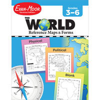
The World Reference & Map Forms

The World Reference & Map Forms

The World Reference & Map Forms
Stock photo: cover may vary

The World Reference & Map Forms Soft cover - 2004

by Moore, Jo Ellen

Add to wish list
  • Used
  • very good
Used - Very good

Description

Monterey, CA, USA: Evan-Moor Corp, 2004. Soft cover. Very Good. Very good condition. Light wear. Binding tight, pages clean. Pictures available upon request.
Ask the seller a question Add to wish list
A$19.59
A$24.75 Delivery to USA
Standard delivery: 6 to 14 days
More delivery options
Ships from Bay Used Books (Ontario, Canada)

Details

  • Title The World Reference & Map Forms
  • Author Moore, Jo Ellen
  • Binding Soft cover
  • Condition Used - Very good
  • Pages 112
  • Volumes 1
  • Language ENG
  • Publisher Evan-Moor Corp, Monterey, CA, USA
  • Publication date 2004
  • Illustrated Yes
  • Features Illustrated, Maps, Table of Contents
  • Bookseller's Inventory # 036994
  • ISBN 9781557999542 / 1557999546
  • Weight 0.7 lbs (0.32 kg)
  • Dimensions 10.7 x 8.4 x 0.3 in (27.18 x 21.34 x 0.76 cm)
  • Age range 08 to 12 years
  • Grade levels 3 - 7
  • Category Education / Teaching
  • Dewey Decimal Code 372
  • Quantity available 1

About Bay Used Books Ontario, Canada

Biblio member since 2023

We are a used book store that has been in business since 1975. We have over 400,000 titles available for in store shopping and have about 30,000 rare/hard to find books that we sell on Amazon, Abe and Alibris.

Terms of Sale: 30 day return guarantee, with full refund including original shipping costs for up to 30 days after delivery if an item arrives misdescribed or damaged.

Browse books from Bay Used Books

Reader reviews for The World Reference & Map Forms

From the publisher

The World--Reference Maps & Forms contains 92 maps, evaluation forms, a crossword puzzle, a word search, and an answer key.

The first section, The World, includes:

  • an introduction of general facts about the world
  • a list of 192 countries in the world
  • a reference political map of the continents
  • a blank world map
  • Robinson and Mercator projection maps
  • globes, showing hemispheres, parallels, and meridians
  • maps of oceans, rivers, mountain ranges, and deserts

The second section, The Continents, includes:

North America:

  • an introduction, listing the countries, area, population, elevations, and fun facts about the continent
  • reference political and physical maps of North America, Canada, the United States, and Mexico
  • blank outline maps of North America, Canada, the United States, and Mexico--shape, political, and physical
  • study maps of each region of the United States and Mexico and the provinces and territories of Canada
  • a reference map of six regions of the United States
  • study maps of Central America, the Greater Antilles, and a reference map of the Lesser Antilles

Africa, Europe, Asia, and Australia

  • an introduction, listing the countries, area, population, elevations, and fun facts about the continent
  • a reference political and a physical map of the continent (a political map of Oceania is included with Australia)
  • blank outline maps of the continent--shape, political, and physical
  • study maps of regions of the continent

Antarctica and the Arctic Region

  • an introduction, listing the area, elevations, and fun facts about the continent
  • reference polar projection maps of Antarctica and the Arctic Region
  • a reference map of the scientific stations in Antarctica
  • blank outline projection maps of Antarctica and the Arctic Region

This resource contains teacher support pages, reproducible student pages, and an answer key. This is a reproducible resource (photocopying of lessons is permitted) for single classroom or individual home use only.

About Evan-Moor
A leader in PreK-8 educational publishing, Evan-Moor has been a trusted partner of teachers and parents for over 40 years. Our mission is helping children learn, and we do this by creating resources that motivate children to learn important skills and concepts across the curriculum while also inspiring a love of learning.

First line

The world's surface consists of land and water.
tracking-