Description:
Storrs-Mansfield.: Maurizio Martino Publisher., No date. Limited edition, 350 copies. Reprint of the 1958 edition.. Green cloth, gilt spine title.. Very good, no dust jacket.. 31x23 cm.. Volume 2 only (of 6). Heavy book, will require extra shipping. weight: 3.7 lb. Illustrated with maps, some folding.
Search Results: mapping the transmississippi west
You searched for:
- Title: mapping the transmississippi west
- Author: carl i wheat
Results 1 - 16 of 16

More Photos
Mapping the Transmississippi West, 1540-1861; Volume 2 - From Lewis and Clark to Fremont,1804-1845.
by Wheat, Carl I.
- Used
- Hardcover
- Condition
- Used - Very good, no dust jacket.
- Edition
- Limited edition, 350 copies. Reprint of the 1958 edition.
- Binding
- Hardcover
- Quantity Available
- 1
- Seller
-
Reno, Nevada, United States
- Item Price
-
A$193.68A$9.30 shipping to USA
Show Details
Item Price
A$193.68
A$9.30
shipping to USA

Mapping the Transmississippi West, Volume Five [Part 1], From the Civil War to the Geological Survey, [Part One of Vol. V; Vol. 5; 1995, new]
by Wheat, Carl I.
- New
- Hardcover
- first
- Condition
- New
- Edition
- First Martino/About Books printing
- Binding
- Hardcover
- Quantity Available
- 1
- Seller
-
Henderson, Nevada, United States
- Item Price
-
A$209.09A$10.07 shipping to USA
Show Details
Description:
Storrs-Mansfield, CT / Parsippany, New Jersey: Martino Fine Books / About Books, 1995. Vol. 5, Part I only (of 6 separate books). As original co-publisher, we are pleased to offer the few remaining individual volumes from our 1995 large-format 6-volume edition that were recently rediscovered in our warehouse. Oversize Hardcover. 9.25" wide by 12.25" tall. This volume is NOT from the later, smaller format 3-volume reprint in which the maps are reduced in size. Offered here is Vol. 5, Part I only (Vol. 5 was issued in 2 separate books). It is BRAND NEW in perfect condition. NO rubbing. NO fading. Bright, clean, square and tight. NO owner's name or bookplate. NOT a remainder. Fresh and crisp -- obviously never read. No date (but 1995, First Martino/About Books printing "strictly limited to 350"). Vol. 5, Part I only. Reprint of the 1963 Institute of Historical Cartography original. MAPPING THE TRANSMISSISSIPPI WEST is a monumental and exceptionally thorough work…
Read More Item Price
A$209.09
A$10.07
shipping to USA
Mapping the Transmississippi West, Volume Five, Part Two, From the Civil War to the Geological Survey, [Part 2 of Vol. V; Vol. 5; 1995, new]
by Wheat, Carl I.
- New
- Hardcover
- first
- Condition
- New
- Edition
- First Martino/About Books printing
- Binding
- Hardcover
- Quantity Available
- 1
- Seller
-
Henderson, Nevada, United States
- Item Price
-
A$210.64A$10.07 shipping to USA
Show Details
Description:
Storrs-Mansfield, CT / Parsippany, New Jersey: Martino Fine Books / About Books, 1995. Vol. 5, Part 2 only (of 6 separate books). As original co-publisher, we are pleased to offer the few remaining individual volumes from our 1995 large-format 6-volume edition that were recently rediscovered in our warehouse. Oversize Hardcover. 9.25" wide by 12.25" tall. This volume is NOT from the later, smaller format 3-volume reprint in which the maps are reduced in size. Offered here is Vol. 5, Part 2 only (Vol. 5 was issued in 2 separate books). It is BRAND NEW in perfect condition. NO rubbing. NO fading. Bright, clean, square and tight. NO owner's name or bookplate. NOT a remainder. Fresh and crisp -- obviously never read. No date (but 1995, First Martino/About Books printing "strictly limited to 350"). Vol. 5, Part 2 only. Reprint of the 1963 Institute of Historical Cartography original. MAPPING THE TRANSMISSISSIPPI WEST is a monumental and exceptionally thorough work…
Read More Item Price
A$210.64
A$10.07
shipping to USA
Mapping the Transmississippi West [1995, 6 separate vols, complete; with large FOLD-OUT Maps
by Wheat, Carl I.
- Used
- Fine
- Hardcover
- Condition
- Used - Fine
- Binding
- Hardcover
- Quantity Available
- 1
- Seller
-
Baltimore, Maryland, United States
- Item Price
-
A$658.50A$4.57 shipping to USA
Show Details
Description:
Martino Fine Books / About Books, 1995. Excellent copies with no significant flaws. Gift quality. Reprint limited to 350 copies. ***Shipped within 24 hours from the beautiful Baltimore inner harbor area. First class service; accurate descriptions. Most items packed in boxes, not envelopes.*** . Hard Cover. Fine.
Item Price
A$658.50
A$4.57
shipping to USA

Stock Photo: Cover May Be Different
Mapping the Transmississippi West, 1540-1861
by Carl I. Wheat
- New
- Hardcover
- Condition
- New
- Binding
- Hardcover
- ISBN 10 / ISBN 13
- 9781578980024 / 157898002X
- Quantity Available
- 1
- Seller
-
Boonsboro, Maryland, United States
- Item Price
-
A$774.39A$7.73 shipping to USA
Show Details
Description:
Martino Publishing, 6/15/2004. Hardcover. New. 5 volumes in 3. Brand new. OUT OF PRINT. Hardcover. Publishers green cloth. Fine binding and covers. Clean, unmarked pages. Contents: v. 1. The Spanish entrada to the Louisiana Purchase, 1540-1804 --v. 2. From Lewis and Clark to Fremont, 1804-1845 --v. 3. From the Mexican War to the boundary surveys, 1846-1854 --v. 4. From the Pacific Railroad surveys to the onset of the Civil War, 1855-1860 --v. 5. From the Civil War to the Geological Survey. This is an oversized or heavy book, that requires additional postage for international delivery outside the US.
Item Price
A$774.39
A$7.73
shipping to USA
Mapping The Transmississippi West 1540-1861: Volumes One - Five, Parts 1 & 2, Complete (350-Copy Limited Edition)
by Wheat, Carl I.; Institute Of Historical Cartography, San Francisco
- Used
- Hardcover
- Condition
- Used - VG In Green Cloth With Gilt Lettering. 5 Books In 6 Volumes, Complete. Oversize. All Pages Clean, Bindings Tight. Pub. 1995?
- Edition
- Reprint
- Binding
- Hardcover
- Quantity Available
- 1
- Seller
-
Vancouver, Washington, United States
- Item Price
-
A$782.45A$17.03 shipping to USA
Show Details
Description:
Parsippany, NJ.: Maurizio Martino. VG In Green Cloth With Gilt Lettering. 5 Books In 6 Volumes, Complete. Oversize. All Pages Clean, Bindings Tight. Pub. 1995? Reprint Of 1957 I.H.C. Edition. Pages: 1378.. Undated. Reprint. Hardcover..
Item Price
A$782.45
A$17.03
shipping to USA
More Photos
Mapping the Transmississippi West
by Wheat, Carl I.
- Used
- Fine
- first
- Condition
- Used - Fine
- Edition
- Limited Edition
- Quantity Available
- 1
- Seller
-
Cincinnati, Ohio, United States
- Item Price
-
A$852.17A$7.75 shipping to USA
Show Details
Description:
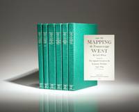
Storrs-Mansfield, CT: Martino Publishing, 1995. Limited Edition. Cloth. Fine. Limited edition of the Mapping the Transmississippi West by Carl L. Wheat, complete with six volumes from Martino Publishing.. Quarto, [six-volumes]. Green cloth, title stamped in gilt on spine. Free of marks or notations. A reprint of the first edition (1957-1963), published by The Institute of Historical Cartography in San Francisco and The Grabhorn Press. This work is a limited edition of 350 copies, not individually numbered. A fine example. The six volumes include the following works: The Spanish Entrada to the Louisiana Purchase 1540-1804; From Lewis and Clark to Fremont 1804-1845; From the Mexican War to the Boundary Surveys 1846-1854; From the Pacific Railroad Surveys to the Onset of the Civil War 1855-1860; and From the Civil War to the Geological Survey (two volumes).
Item Price
A$852.17
A$7.75
shipping to USA

Mapping the Transmississippi West 1540-1861, 5 volumes in 6
by Wheat, Carl I.
- Used
- as new
- Hardcover
- Condition
- As New
- Binding
- Hardcover
- Quantity Available
- 1
- Seller
-
Atlanta, Georgia, United States
- Item Price
-
A$929.64A$10.07 shipping to USA
Show Details
Description:
Storrs-Mansfield, CT / Parsippany, NJ: Martino Publishing / About Books, 1995. Hardcover. As New. 12.3x9.1x7.7in. reprint edition, limited to 350 copies, not issued with dust jackets. The full-size facsimile reprint of Wheat's monumental work initially published from 1957 to 1963. This edition has large fold-out maps, just like the original. Not to be confused with the small-format edition, with maps reduced in size, published in 3 volumes in 2004. 21.70lb 12.3x9.1x7.7in EXTRA SHIPPING CHARGES NECESSARY
Item Price
A$929.64
A$10.07
shipping to USA
More Photos
Mapping the Transmississippi West [1995, 6 separate vols, complete; with large FOLD-OUT maps; new, in publisher's shrinkwrap & PUBLISHER'S CARDBOARD SHIPPING BOX
by Wheat, Carl I.
- New
- Hardcover
- first
- Condition
- New
- Edition
- First Martino/About Books printing
- Binding
- Hardcover
- Quantity Available
- 1
- Seller
-
Henderson, Nevada, United States
- Item Price
-
A$1,003.24A$10.07 shipping to USA
Show Details
Description:
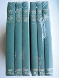
Storrs-Mansfield, CT / Parsippany, New Jersey: Martino Fine Books / About Books, 1995. 6 separate volumes, complete [5 volumes bound in 6 books WITH LARGE FOLD-OUT MAPS -- just like the first edition]. SEE PHOTOS. Each of the 6 books in this 1995 large format edition measures 9.25" wide by 12.25" tall. [This is NOT the later, smaller format 3-volume reprint in which the maps are reduced in size]. Unlike later reduced-size editions, the maps in this 1995 six-volume edition measure as large as 21" by 33" when unfolded. SEE PHOTOS. As original co-publisher, we are pleased to offer the few remaining sets of the 1995 large-format 6-volume edition (recently rediscovered in our warehouse). They are BRAND NEW in perfect condition. STILL SEALED in the publisher's clear plastic SHRINKWRAP and the PUBLISHER'S CARDBOARD SHIPPING BOX. NO rubbing. NO fading. Bright, clean, square and tight. NO owner's name or bookplate. NOT a remainder. Fresh and crisp -- obviously…
Read More Item Price
A$1,003.24
A$10.07
shipping to USA
Mapping of the Transmississippi West 1540-1861 5 volumes in 6 books
by Carl I. Wheat
- Used
- very good
- Hardcover
- Condition
- Used - Very Good
- Binding
- Hardcover
- Quantity Available
- 1
- Seller
-
king of Prussia, Pennsylvania, United States
- Item Price
-
A$1,917.38A$4.65 shipping to USA
Show Details
Description:
The Institute of Historical Cartography, 1957. Hardcover. Very Good. limited edition of 1000 is edition all books in vg condition green spines and very light colored buckram boards
Item Price
A$1,917.38
A$4.65
shipping to USA
![[MAPPING THE WEST - COMPLETE SET IN PERFECT CONDITION]. Mapping the Transmississippi West, 1540-1861](https://d3525k1ryd2155.cloudfront.net/h/634/920/1437920634.0.m.jpg)
More Photos
[MAPPING THE WEST - COMPLETE SET IN PERFECT CONDITION]. Mapping the Transmississippi West, 1540-1861
by Wheat, Carl I.
- Used
- near fine
- first
- Condition
- Used - Near Fine
- Edition
- First Edition
- Quantity Available
- 1
- Seller
-
Lockhart, Texas, United States
- Item Price
-
A$2,711.45A$12.40 shipping to USA
Show Details
Description:
San Francisco: Institute of Historical Cartography, 1963. First Edition. Near Fine. Together five vols. in six. Large folios (355 x 260 mm). Original publisher's dark green buckram over gray linen, spines gilt-stamped; standard offsetting inside boards from publisher's brown dust-wrappers, now no longer present. Unread copy. ONE OF THE GREAT WORKS OF CARTOGRAPHIC HISTORY -- easily the most important work on Western American maps from 1540 to the Civil War. "Wheat" (as it is known) is the ne-plus-ultra of its genre, and takes pride of place as the preeminent work on this subject, surely never to be surpassed. Comprising more than 1,600 pages and featuring more than 300 high-quality reproductions of rare maps and plans (some double-page), plus a "Bibliocartography" describing 1,302 maps, "Wheat" is nothing short of epic. Howell ("California 50" no. 1655) assigns justifiable praise: "A truly monumental work on the cartography of the West, from the Spanish Entrada to the Geological Survey of 1877. It…
Read More Item Price
A$2,711.45
A$12.40
shipping to USA
![Mapping the Transmississippi West 1540-1861. [5 Volumes in 6, Complete, Plus Prospectus Volume]](https://d3525k1ryd2155.cloudfront.net/h/642/473/1462473642.0.m.jpg)
Mapping the Transmississippi West 1540-1861. [5 Volumes in 6, Complete, Plus Prospectus Volume]
by Wheat, Carl I.
- Used
- near fine
- Hardcover
- first
- Condition
- Used - Near Fine
- Edition
- First Edition
- Binding
- Hardcover
- Quantity Available
- 1
- Seller
-
GRASS VALLEY, California, United States
- Item Price
-
A$3,098.80FREE shipping to USA
Show Details
Description:
San Francisco: The Institute of Historical Cartography. Near Fine. 1957-1963. First Edition. Hardcover. Volumes 1-4 with light offset tanning from plain brown paper jackets that the volumes were originally issued with. ; In an addition of 1000 copies, designed by the Grabhorn Press. Green cloth backs, lettered in gilt and linen over boards; over 300 reproductions of historical maps, many folding. Without the plain paper jackets. The Prospectus Volume bound the same , contains 8 printed leaves, reproducing title pages for volumes 2 through 5, along with descriptions of the project, and reviews. This followed by 7 blank leaves. There are two 8 page printed announcements, one inserted at first title page, the other laid in ; Folio 13" - 23" tall; Volume One, The Spanish Entrada to the Louisiana Purchase, 1540-1804; Volume Two, From Lewis and Clark to Fremont, 1804-1845; Volume Three, From the Mexican War to the Boundary Surveys 1846-1854; Volume Four, From the Pacific Railroad…
Read More Item Price
A$3,098.80
FREE shipping to USA

Mapping the Transmississippi West
by Wheat, Carl I.
- Used
- very good
- Hardcover
- first
- Condition
- Used - Very good
- Binding
- Hardcover
- Quantity Available
- 1
- Seller
-
Decatur, Georgia, United States
- Item Price
-
A$3,098.80A$6.20 shipping to USA
Show Details
Description:
SF: Institute of Historical Cartography, 1957. Hardcover. Very good. Hardcover. First Edition. 1000cc designed by the Grabhorn Press. xiv, 254pp+ index; xiii, 271pp+ index; xiii, 338pp+ index; xiii, 249pp+ index; xviii, 222pp; 223-442pp+ index. Five volumes in six, illustrated throughout with facsimile maps, many of which are folding; color frontispieces. 14x10", A very good set bound in publisher's green cloth-backed beige cloth, spines lettered in gilt. An essential, monumental and exceptionally thorough work detailing the cartography of the American west from Coronado's "entrada" in 1540 through the U.S. Geological Survey in 1884. Volume one: The Spanish Entrada to the Louisiana Purchase; Volume two: From Lewis and Clark to Fremont 1804-1845; Volume three: The Mexican War to the Boundary Survey 1846-1854; Volume four: Pacific Railroad Surveys to the Onset of the Civil War 1855-1860; Volume five parts one and two: Civil War to the Geological Survey.
Item Price
A$3,098.80
A$6.20
shipping to USA

Mapping the Transmississippi West 1540-1861 Five Volume Set (Volume Five in Two Parts)
by Wheat, Carl I
- Used
- very good
- Hardcover
- Condition
- Used - Very Good
- Binding
- Hardcover
- Quantity Available
- 1
- Seller
-
Portland, Oregon, United States
- Item Price
-
A$3,718.56A$10.07 shipping to USA
Show Details
Description:
Institute of Historical Cartography , 1957-1963. Hardcover. Very Good/Missing. Folio. Map reproductions by Charles R. Wood & Associates of San Francisco. The bindings are tight and show very light rubbing to extremities. Corners are sharp. Some minor, isolated wear to text block edges. Text and images unmarked, foldout maps intact. Volume One has a thin strip of paper affixed to the front pastedown (possibly from an old bookplate). Volume Four shows very light toning to free front endpapers. Overall a very handsome set in VG+ condition. Volume One: published 1957; 364pp. Volume Two: published 1958; 281pp. Volume Three: published 1959; 349pp. Volume Four: published 1960; 260pp. Volume Five (in two parts): published 1963; 487pp. PLEASE NOTE: THIS SET IS NOT ELIGIBLE FOR INTERNATIONAL SHIPPING AND WILL REQUIRE A SUBSTANTIAL ADDITIONAL SHIPPING FEE TO DOMESTIC ADDRESSES.
Item Price
A$3,718.56
A$10.07
shipping to USA
Mapping the Transmississippi West 1540-1861..
by WHEAT, Carl I.
- Used
- Condition
- Used
- Quantity Available
- 1
- Seller
-
Bryn Mawr,, Pennsylvania, United States
- Item Price
-
A$3,873.50A$7.75 shipping to USA
Show Details
Description:
WHEAT, Carl I. Mapping the Transmississippi West 1540-1861...Orig. cloth-backed linen boards. Folios. San Francisco: Institute of Historical Cartography, 1957-63. 5 vols in 6. First edition. Limited to 1000 sets printed by the Grabhorn Press. Fine.
Item Price
A$3,873.50
A$7.75
shipping to USA

MAPPING THE TRANSMISSISSIPPI WEST 1540-1861.
by WHEAT, CARL I.
- Used
- Hardcover
- first
- Condition
- Used
- Edition
- First edition
- Binding
- Hardcover
- Quantity Available
- 1
- Seller
-
Greencastle, Pennsylvania, United States
- Item Price
-
A$5,035.55A$14.72 shipping to USA
Show Details
Description:
San Francisco: Institute of Historical Cartography, 1957-1963., 1957-1963.. First edition. First Editions. Folio. Limited to 1000 sets. 5 Volumes in 6. xiv, 264pp.; xiii, 281pp.; xiii, 349pp., xiii, 260pp.; xviii, 487pp. Facsimilies of numerous maps, some color, some folded. Green levant-textured quarter buckram with sage buckram cover. Titles in gilt on spine. Fore-edge and tail left untrimmed. The series was designed by the Grabhorn Press and the first volume was printed by them. Volumes two, three, and four were produced by Taylor & Taylor, and Volume five by James Printing Company, all of San Francisco. The type for all volumes was set by Mackenzie & Harris, Inc.. This five-volume work describes the maps of Western America from the earliest cartographic conjectures to Spanish explorations of the fifteenth century, through early exploration and overland travel up to the beginnings of the great surveys and the Civil War. Dale Morgan's contribution to this classic work was greater than…
Read More Item Price
A$5,035.55
A$14.72
shipping to USA

Didn’t find what you’re looking for?
Try adding this search to your want list. Millions of books are added to our site everyday and when we find one that matches your search, we’ll send you an email. Best of all, it’s free.
Add to Want List

Are you a frequent reader or book collector?
Join the Bibliophile's Club and save 10% on every purchase, every day — up to $20 savings per order!

Social Responsibility
Did you know that since 2004, Biblio has used its profits to build 16 public libraries in rural villages of South America?
