Description:
Bern [Switzerland]: Hans Körber [Koerber] (Huber & Comp.), 1861. Very Good condition. SEE PHOTOS. Karten etwas fleckig (maps somewhat spotted). This is Blatt VIII, Aarau - Luzern Zug - Zürich [Zurich]. The map is dated 1861 and has 21 sections. It is printed on paper, then mounted on cloth (i.e. backed with linen). When folded the map measures 19 cm tall x 11 cm wide. When unfolded, 57 cm tall x 79 cm wide. SEE PHOTOS. Linen-backed, steel-engraved folding map in 21 segments. Scale 1:100,000.. 1861 edition. Hardcover. Very Good (somewhat spotted).
Stato del Mogol con le coste del Malabar e del Coromandel by Zatta, Antonio - 1791
by Zatta, Antonio

Stato del Mogol con le coste del Malabar e del Coromandel
by Zatta, Antonio
- Used
- very good
Venezia: Presso Antonio Zatta e figli, 1791. Unbound Map. Very Good/No Jacket. Map, 40.4 x 31.2 cm. Only minor wear. A map of the Mughal Empire in India
-
Bookseller
Dinsmore Books
 (US)
(US)
- Format/Binding Unbound Map
- Book Condition Used - Very Good
- Jacket Condition No Jacket
- Quantity Available 1
- Publisher Presso Antonio Zatta e figli
- Place of Publication Venezia
- Date Published 1791
- Product_type
![Blatt 8 (VIII) : Aarau - Luzern Zug - Zürich [Zurich] : Topographische Karte der Schweiz :...](https://d3525k1ryd2155.cloudfront.net/h/777/796/330796777.0.m.jpg)
More Photos
Blatt 8 (VIII) : Aarau - Luzern Zug - Zürich [Zurich] : Topographische Karte der Schweiz : Massstab 1 : 100,000, Vermessen und herausgegeben unter Aufsicht von General G. H. Dufour
by Dufour, General G. H. [Guillaume-Henri]
- Used
- Hardcover
- Condition
- Used - Very Good (somewhat spotted)
- Edition
- 1861 edition
- Binding
- Hardcover
- Quantity Available
- 1
- Seller
-
Henderson, Nevada, United States
- Item Price
-
A$271.15
Show Details
Item Price
A$271.15

More Photos
SMITH'S MAP OF PHILADELPHIA AND VICINITY
by Gannett, Henry; Chief Topographer, U. S. Geological Survey
- Used
- Hardcover
- first
- Condition
- Used - Good+
- Edition
- First Edition Thus; Second Printing
- Binding
- Hardcover
- Quantity Available
- 1
- Seller
-
Fairfield, New Jersey, United States
- Item Price
-
A$271.15
Show Details
Description:
Philadelphia: J. L. Smith. Good+. 1904. First Edition Thus; Second Printing. Hardcover. U. S. Geological Survey, surveyed in 1894, edition of 1902, printed in 1904. This is a 30 1/2" x 38 1/2" USGS map that J. L. Smith of Philadelphia, sometime after issue, sectioned (4 sections x 6 sections) and mounted on linen to create a folding pocket map. It is mounted in a 10 x 5.5 inch dark brown embossed and gilded hardcover folder that bears the title "Smith's Map of Philadelphia and Vicinity". The map covers the area north and west well past Norristown and south into Delaware, as well as a good part of New Jersey beyond Camden. It shows the local road network and was made for local travel. The inside cover has original owner's signature. Cover graded G+ due to rubbing along the spine edges & corners. The map is in VG condition. ; Fold out cloth Map; Small 4to 9" - 11" tall .
Item Price
A$271.15

More Photos
Arab navigation in the Indian Ocean before the coming of the Portuguese
by Ahmad ibn Majid al-Sadi , G.R. Tibbetts
- Used
- Hardcover
- first
- Condition
- Very Good: Cover some light shelf wear, inside as new
- Edition
- First Edition
- Binding
- Hardcover
- ISBN 10 / ISBN 13
- 9780718909000 / 0718909003
- Quantity Available
- 1
- Seller
-
Berg en dal, Netherlands
- Item Price
-
A$398.40
Show Details
Description:
Ahmad ibn Majid al-Sadi, G.R. Tibbetts - Arab Navigation in the Indian Ocean before the coming of the Portuguese - London, The Royal Asiatic Society of Great Britain and Ireland; Luzac and Company Ltd, 1971 - First Edition - Hardcover - 614pp + 4 maps (out of 7)- 22x14 cmCondition Very Good: Cover some light shelf wear, inside as new. Four out of seven maps present: Chart of the Arabian Sea, India and the Bay of Bengal, Red Sea and Gulf of Eden, East African CoastIf you have any questions or want to see more pictures, feel free to ask.Your book will be securely packed and shipped with tracking number, signed & insured.
Item Price
A$398.40

More Photos
Britannicae Insulae: Antique map of Great Britain
by Robert de Vaugondy
- Used
- very good
- Condition
- Used - Very Good
- Quantity Available
- 1
- Seller
-
Providence, Seychelles
- Item Price
-
A$271.15
Show Details
Description:
FULL TITLE: Britannicae, Insulae in quibus Albion Seu Britannia Major, et Ivernia seu Britannia Minor juxta Ptolemaei mentem divisae tùm in suas majores partes, tùm in populos exhibentur, à Nicolao sanson Christ, Regis Geographo, Revisae, et ad observationes astronomicas redactae, accurante Robert de Vaugondy filio, gum Privilegio Regis'DATE PRINTED: 1750 IMAGE SIZE: Approx 50.0 x 55.0cm, 19.5 x 21.5 inches (Large); Please note that this is a folding map.TYPE: Large antique 18th-century atlas map, printed on thick, good quality paper. partially hand-colored.CONDITION: Good; suitable for framing. Please check the scan for any blemishes prior to making your purchase. Virtually all antiquarian maps and prints are subject to some normal aging due to use and time which is not obtrusive unless otherwise stated. We offer a no-questions-asked return policy.AUTHENTICITY: This is an authentic historic map, published at the date stated above. It is not a modern copy.VERSO: Short map title printed on the…
Read More Item Price
A$271.15

More Photos
Yellowstone Through the Stereoscope: with folding map
- Used
- very good
- Hardcover
- Condition
- Used - Very Good
- Jacket Condition
- Good
- Binding
- Hardcover
- Quantity Available
- 1
- Seller
-
Saint Albans, Vermont, United States
- Item Price
-
A$309.88
Show Details
Description:
Small, pocket book. Pages clean and tight. Some staining on the cover and edges of the pages. Map has one small tear and one small hole but otherwise in very good condition. Proceeds from the sale of this book support library services and programming.
Item Price
A$309.88
More Photos
Blatt 8 (VIII) : Aarau - Luzern Zug - Zürich [Zurich] : Topographische Karte der Schweiz : Massstab 1 : 100,000, Vermessen und herausgegeben unter Aufsicht von General G. H. Dufour
by Dufour, General G. H. [Guillaume-Henri]
- Used
- Hardcover
- Condition
- Used - Very Good (somewhat spotted)
- Edition
- 1861 edition
- Binding
- Hardcover
- Quantity Available
- 1
- Seller
-
Henderson, Nevada, United States
- Item Price
-
A$271.15
Show Details
Description:
Bern [Switzerland]: Hans Körber [Koerber] (Huber & Comp.), 1861. Very Good condition. SEE PHOTOS. Karten etwas fleckig (maps somewhat spotted). This is Blatt VIII, Aarau - Luzern Zug - Zürich [Zurich]. The map is dated 1861 and has 21 sections. It is printed on paper, then mounted on cloth (i.e. backed with linen). When folded the map measures 19 cm tall x 11 cm wide. When unfolded, 57 cm tall x 79 cm wide. SEE PHOTOS. Linen-backed, steel-engraved folding map in 21 segments. Scale 1:100,000.. 1861 edition. Hardcover. Very Good (somewhat spotted).
Item Price
A$271.15
More Photos
SMITH'S MAP OF PHILADELPHIA AND VICINITY
by Gannett, Henry; Chief Topographer, U. S. Geological Survey
- Used
- Hardcover
- first
- Condition
- Used - Good+
- Edition
- First Edition Thus; Second Printing
- Binding
- Hardcover
- Quantity Available
- 1
- Seller
-
Fairfield, New Jersey, United States
- Item Price
-
A$271.15
Show Details
Description:
Philadelphia: J. L. Smith. Good+. 1904. First Edition Thus; Second Printing. Hardcover. U. S. Geological Survey, surveyed in 1894, edition of 1902, printed in 1904. This is a 30 1/2" x 38 1/2" USGS map that J. L. Smith of Philadelphia, sometime after issue, sectioned (4 sections x 6 sections) and mounted on linen to create a folding pocket map. It is mounted in a 10 x 5.5 inch dark brown embossed and gilded hardcover folder that bears the title "Smith's Map of Philadelphia and Vicinity". The map covers the area north and west well past Norristown and south into Delaware, as well as a good part of New Jersey beyond Camden. It shows the local road network and was made for local travel. The inside cover has original owner's signature. Cover graded G+ due to rubbing along the spine edges & corners. The map is in VG condition. ; Fold out cloth Map; Small 4to 9" - 11" tall .
Item Price
A$271.15
More Photos
Arab navigation in the Indian Ocean before the coming of the Portuguese
by Ahmad ibn Majid al-Sadi , G.R. Tibbetts
- Used
- Hardcover
- first
- Condition
- Very Good: Cover some light shelf wear, inside as new
- Edition
- First Edition
- Binding
- Hardcover
- ISBN 10 / ISBN 13
- 9780718909000 / 0718909003
- Quantity Available
- 1
- Seller
-
Berg en dal, Netherlands
- Item Price
-
A$398.40
Show Details
Description:
Ahmad ibn Majid al-Sadi, G.R. Tibbetts - Arab Navigation in the Indian Ocean before the coming of the Portuguese - London, The Royal Asiatic Society of Great Britain and Ireland; Luzac and Company Ltd, 1971 - First Edition - Hardcover - 614pp + 4 maps (out of 7)- 22x14 cmCondition Very Good: Cover some light shelf wear, inside as new. Four out of seven maps present: Chart of the Arabian Sea, India and the Bay of Bengal, Red Sea and Gulf of Eden, East African CoastIf you have any questions or want to see more pictures, feel free to ask.Your book will be securely packed and shipped with tracking number, signed & insured.
Item Price
A$398.40
More Photos
Britannicae Insulae: Antique map of Great Britain
by Robert de Vaugondy
- Used
- very good
- Condition
- Used - Very Good
- Quantity Available
- 1
- Seller
-
Providence, Seychelles
- Item Price
-
A$271.15
Show Details
Description:
FULL TITLE: Britannicae, Insulae in quibus Albion Seu Britannia Major, et Ivernia seu Britannia Minor juxta Ptolemaei mentem divisae tùm in suas majores partes, tùm in populos exhibentur, à Nicolao sanson Christ, Regis Geographo, Revisae, et ad observationes astronomicas redactae, accurante Robert de Vaugondy filio, gum Privilegio Regis'DATE PRINTED: 1750 IMAGE SIZE: Approx 50.0 x 55.0cm, 19.5 x 21.5 inches (Large); Please note that this is a folding map.TYPE: Large antique 18th-century atlas map, printed on thick, good quality paper. partially hand-colored.CONDITION: Good; suitable for framing. Please check the scan for any blemishes prior to making your purchase. Virtually all antiquarian maps and prints are subject to some normal aging due to use and time which is not obtrusive unless otherwise stated. We offer a no-questions-asked return policy.AUTHENTICITY: This is an authentic historic map, published at the date stated above. It is not a modern copy.VERSO: Short map title printed on the…
Read More Item Price
A$271.15
More Photos
Yellowstone Through the Stereoscope: with folding map
- Used
- very good
- Hardcover
- Condition
- Used - Very Good
- Jacket Condition
- Good
- Binding
- Hardcover
- Quantity Available
- 1
- Seller
-
Saint Albans, Vermont, United States
- Item Price
-
A$309.88
Show Details
Description:
Small, pocket book. Pages clean and tight. Some staining on the cover and edges of the pages. Map has one small tear and one small hole but otherwise in very good condition. Proceeds from the sale of this book support library services and programming.
Item Price
A$309.88

Stock Photo: Cover May Be Different
Lettera Giustificativa Di Antonio Zatta Per Il Libro Uscito Sotto Il Suo Nome Nello Scorso Gennajo 1760. Intitolato Dimostrazione Dell'ossquio, E ... Ed I Ministri Di Sua... (Italian Edition)
by Antonio Zatta
- Used
- good
- Paperback
- Condition
- Used - Good
- Binding
- Paperback
- ISBN 10 / ISBN 13
- 9781277285642 / 1277285640
- Quantity Available
- 1
- Seller
-
HOUSTON, Texas, United States
- Item Price
-
A$37.77
Show Details
Description:
Nabu Press, 2012-03-08. Paperback. Good.
Item Price
A$37.77

Stock Photo: Cover May Be Different
Saggio Di Memorie Degli Uomini Illustri Di Asolo... (Italian Edition)
by Pietro Trieste de'Pellegrini, Antonio Zatta
- Used
- good
- Paperback
- Condition
- Used - Good
- Binding
- Paperback
- ISBN 10 / ISBN 13
- 9781276760355 / 1276760353
- Quantity Available
- 1
- Seller
-
HOUSTON, Texas, United States
- Item Price
-
A$47.85
Show Details
Description:
Nabu Press, 2012-03-02. Paperback. Good.
Item Price
A$47.85

Stock Photo: Cover May Be Different
Varj Epigrammi Della Greca Antologia Recati in Lingua Volgare (1752)
by Antonio Zatta Publisher
- New
- Condition
- New
- ISBN 10 / ISBN 13
- 9781166279240 / 1166279243
- Quantity Available
- 10
- Seller
-
Southport, Merseyside, United Kingdom
- Item Price
-
A$47.23
Show Details
Description:
New.
Item Price
A$47.23

Stock Photo: Cover May Be Different
Nuovi Ragguagli Dell' Esperienze D'Elettrometria Organica (1794)
by Antonio Zatta Publisher
- New
- Condition
- New
- ISBN 10 / ISBN 13
- 9781166940577 / 1166940578
- Quantity Available
- 10
- Seller
-
Southport, Merseyside, United Kingdom
- Item Price
-
A$51.54
Show Details
Description:
New.
Item Price
A$51.54
Li Governi Di Lorena, Barr, Ed Alsazia Di Nuova Projezione.
by PASQUALI, G.V. [Drawn by] and ZULIANI, G. [Engraver]. [ZATTA, Antonio]
- Used
- Condition
- Used
- Quantity Available
- 1
- Seller
-
London, London, United Kingdom
- Item Price
-
A$96.91
Show Details
Description:
Venice: Antonio Zatta. [c. 1777]. 30.2 x 41.5 cm. Original outline colour, with coloured title cartouche to lower left corner. Double page map of Alsace and Lorraine. Blank on verso. Very good condition.
Item Price
A$96.91

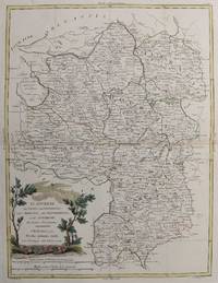
Li Governi dell' Isola Di Francia, Ed Orleanois. Di Nuova Projezione.
by ZATTA, Antonio
- Used
- Condition
- Used
- Quantity Available
- 1
- Seller
-
London, London, United Kingdom
- Item Price
-
A$96.91
Show Details
Description:
Venice: Antonio Zatta. 1776. 38.8 x 28.9 cm. Original outline colour, with coloured title cartouche to lower right corner. Double page map. Blank on verso. Very good condition.
Item Price
A$96.91
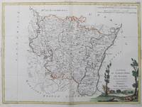
Li Governi del Berri, del Nivernois, della Marche, del Bourbonnois, e dell' Auvergne Di Nuova Projezione.
by PASQUALI, G.V. [Drawn by] and ZULIANI, G. [Engraver]. [ZATTA, Antonio]
- Used
- Condition
- Used
- Quantity Available
- 1
- Seller
-
London, London, United Kingdom
- Item Price
-
A$96.91
Show Details
Description:
Venice: Antonio Zatta. 1776. 40 x 30 cm. Original outline colour, with coloured title cartouche to lower left corner. Double page map of the regions of Auvergne, Borbonnais and southern Marche. Blank on verso. Very good condition.
Item Price
A$96.91

Li Governi D'Angi� del Saumurois, della Touraine, e Poitou, D'Aunis, e Saintonge, con quelle D'Angoumois.
by ZATTA, Antonio
- Used
- Condition
- Used
- Quantity Available
- 1
- Seller
-
London, London, United Kingdom
- Item Price
-
A$96.91
Show Details
Description:
Venice: Antonio Zatta. 1777. 39.8 x 29.9 cm. Original outline colour, with coloured title cartouche to lower left corner. Double page map of Poitou and Saintonge with their adjacent regions. Blank on verso. Very good condition.
Item Price
A$96.91
Stock Photo: Cover May Be Different
Nuovi Ragguagli Dell' Esperienze D'Elettrometria Organica (1794) (Italian Edition)
by Antonio Zatta Publisher
- New
- Paperback
- Condition
- New
- Binding
- Paperback
- ISBN 10 / ISBN 13
- 9781166940577 / 1166940578
- Quantity Available
- 5
- Seller
-
campbelltown, Florida, United States
- Item Price
-
A$29.44
Show Details
Description:
Kessinger Publishing, LLC. paperback. New. 6x0x9. Brand New Book in Publishers original Sealing
Item Price
A$29.44

More Photos
MAP OF ENGLAND & WALES
by ZATTA, ANTONIO
- Used
- good
- Condition
- Used - Good
- Quantity Available
- 1
- Seller
-
Ross on Wye, Herefordshire, United Kingdom
- Item Price
-
A$125.98
Show Details
Description:
1778 AN ORIGINAL 18th CENTURY ITALIAN MAP OF THE SOUTHERN PART OF ENGLAND & WALES,HAND COLOURING, MAP MEASURES APPROX 16 x 12 INCHES WITHOUT MARGINS. CENTRE FOLD AS PUBLISHED,SMALL STAIN TO TOP RIGHT CORNER OF MAP ( see images) FEW MINOR BLEMISHES OR LIGHT SPOT OF FOXING, OVERALL IN GOOD - VERY GOOD CONDITION. MAP IS IN A REMOVABLE PLASTIC BAG AND DOES SHOW SOME REFLECTIONS IN IMAGES. FURTHER IMAGES AVAILABLE UPON REQUEST. EXTRA POSTAGE COSTS MAY APPLY TO OVERSEAS ORDERS.. No Binding. Good.
Item Price
A$125.98

More Photos
The Sky and the Forest
by Forester, C.S
- Used
- very good
- Hardcover
- first
- Condition
- Used - Very Good
- Jacket Condition
- Very Good
- Edition
- First Edition
- Binding
- Hardcover
- Quantity Available
- 1
- Seller
-
Salem, Oregon, United States
- Item Price
-
A$54.06A$32.43Save A$13.96!
Show Details
Description:
C.S. Forester: The Sky and the Forest. Little, Brown and Company, Boston. Stated First Edition First Printing Thus August, 1948. Cover price $2.75. Used. VG BOOK/VG UNCLIPPED DUST JACKET. A story of a central Africa. By C.S. Forester, author of the Admiral Hornblower series.
Item Price
A$54.06A$32.43
Save A$13.96
!
![Alaska and Klondike Region; [With inset of Klondike Region on the Upper Yukon detail] [From an...](https://d3525k1ryd2155.cloudfront.net/h/062/537/1339537062.0.m.jpg)
Alaska and Klondike Region; [With inset of Klondike Region on the Upper Yukon detail] [From an atlas, "Gazetteer of Alaska and Yukon Region " pp. 105 and 106]
by Miller, J. Martin
- Used
- very good
- Condition
- Used - Very Good
- Edition
- Unknown
- Quantity Available
- 1
- Seller
-
Sebastopol, California, United States
- Item Price
-
A$60.43
Show Details
Description:
Chicago: J. Martin Miller, 1899. Unknown. Map. Very Good. [Map copyright 1899, printing date of Atlas later] [19.875x15.125in]; Colored map of Alaska with steamer routes from Portland and Seattle, insets of the Klondike Region on the Upper Yukon and Western portion of Aleutian Islands; On verso index of places and names with two large black and white images; Age toning to all edges, water stain marks on bottom, slight printing offset of colors, small chips and closed tears to lower edge;.
Item Price
A$60.43

Zemepis Sveta - Monsunova Asie
by De La Blache, P. Vidal; Gallois, L
- Used
- Hardcover
- Condition
- Used - Very Good Condition
- Jacket Condition
- No Dust Jacket
- Binding
- Hardcover
- Quantity Available
- 1
- Seller
-
Oak Point, Texas, United States
- Item Price
-
A$92.96
Show Details
Description:
Aventinum, Prague, Czechoslovakia, 1931. Hardcover. Very Good Condition/No Dust Jacket. Text entirely in Czech. Geography book on Asia with numerous photographs and maps. 1930 edition also available. Size: 4mo - over 9 3/4" - 12" tall. 400 pp. Pages are yellowed, but are tight and clean. Moderate shelfwear along the spine. Corners are lightly bumped. Quantity Available: 1. Shipped Weight: 3-5 pounds. Category: Travel & Places; Non-English Language::Czech; Pictures of this item not already displayed here available upon request. Inventory No: 001228. . Additional shipping charges may apply.
Item Price
A$92.96

Zemepis Sveta - Monsunova Asie
by De La Blache, P. Vidal; Gallois, L
- Used
- Hardcover
- Condition
- Used - Very Good Condition
- Jacket Condition
- No Dust Jacket
- Binding
- Hardcover
- Quantity Available
- 1
- Seller
-
Oak Point, Texas, United States
- Item Price
-
A$92.96
Show Details
Description:
Aventinum, Prague, Czechoslovakia, 1930. Hardcover. Very Good Condition/No Dust Jacket. Text entirely in Czech. Geography book on Asia with numerous photographs and maps. 1931 edition also available. Size: 4mo - over 9 3/4" - 12" tall. 400 pp. Pages are yellowed, but are tight and clean. Moderate shelfwear along the spine. Corners are lightly bumped. Quantity Available: 1. Shipped Weight: 3-5 pounds. Category: Travel & Places; Non-English Language::Czech; Pictures of this item not already displayed here available upon request. Inventory No: 001227. . Additional shipping charges may apply.
Item Price
A$92.96

North America from the Best Authorities, Russell, ca.1800
by Russell
- Used
- Condition
- Used
- Quantity Available
- 1
- Seller
-
Plymouth, Devon, United Kingdom
- Item Price
-
A$38.76
Show Details
Description:
Russell, J. : A General Map of North America from the Best Authorities. Nd but ca.1800. From "A New Geographical, Historical and Commercial Grammar and Present State of Several Kingdoms of the World." Copper engraving. Size approx 200 x 230mm. Two neat folds. Some age colouring to edges, otherwise very clean and bright.
Item Price
A$38.76

Asia from the Best Authorities, Russell, ca.1800
by Russell
- Used
- Condition
- Used
- Quantity Available
- 1
- Seller
-
Plymouth, Devon, United Kingdom
- Item Price
-
A$38.76
Show Details
Description:
Russell, J. : Asia from the Best Authorities. Nd but ca.1800. From "A New Geographical, Historical and Commercial Grammar and Present State of Several Kingdoms of the World". Copper engraving. Size approx 200 x 230mm. Two neat folds. Some age colouring to edges, otherwise clean and bright. Includes Arabia, India, Borneo, Japan, China and eastern Russia.
Item Price
A$38.76
![MAP OF UTAH [Territory]](https://d3525k1ryd2155.cloudfront.net/h/836/461/1485461836.0.m.jpg)
More Photos
MAP OF UTAH [Territory]
- Used
- Condition
- Used - Very Good-
- Edition
- Original
- Quantity Available
- 1
- Seller
-
Williamsburg, Virginia, United States
- Item Price
-
A$100.71
Show Details
Description:
New York, Richmond, Chicago, & Toledo: H. H. Hardesty, 1885. Original color lithographed map printed by Rand, McNally & Company, Engravers and published in HARDESTY'S HISTORICAL AND GEOGRAPHICAL ENCYCLOPEDIA: SPECIAL VIRGINIA EDITION. 19 3/8 inches by 13 1/4 inches on a 21" X 14 1/2" sheet. The map depicts the Territory of Utah in its final form--large areas had been removed and ceded to Nevada, Colorado, Wyoming, and Nebraska since Utah became a U. S. Territory in 1850. The issue of polygamy prevented statehood until it was finally granted in 1896. This map features railroads and topography and uses color to set off counties from each other. Unlike most atlas maps of the period, this map identifies most small towns. The map is guaranteed to be moe than 135 years old. The map is in about very good condition: generally clean and bright, with slight toning of paper and one faint water stain near the center-left edge of the map.. Original. Single Sheet. Very Good-. Elephant…
Read More Item Price
A$100.71

Philips Special Map of the Nile, The Advance on Khartum and the Environs of Omdurman. Cc1900
by George Philips and Son,
- Used
- Condition
- Used
- Quantity Available
- 1
- Seller
-
Plymouth, Devon, United Kingdom
- Item Price
-
A$50.39
Show Details
Description:
Philips Special map of the Nile illustrating the Advance on Khartum [Khartoum] with an enlargement of the environs of Omdurman [Omdur]. George Philips and Son, London and Liverpool Ca 1900. 580mm x 900mm folded map. Front title wrapper has come loose, not affecting map area. Three maps are displayed within the sheet. Map1. Map of the Nile Valley 520mm x 300mm showing the approaches of Khartum. Scale 1inch to 100 Geographical miles. Coloured indicating Possessions and Protectorates of European Powers. Map 2. Special map of the Nile from Dongola to Khartum. Scale 16 miles to the inch. Coloured. In set in this map is Map3. Environs of Omdurman, Scale 5 statute miles to the inch. Some small breaks at some folds, not affecting imagery or use of map. Title label is damaged, the map is clean and bright, probably unused. A very interesting record.
Item Price
A$50.39

Last Tales
by Dinesen, Isak
- Used
- very good
- Hardcover
- first
- Condition
- Used - Very Good
- Jacket Condition
- Good+
- Edition
- First Edition
- Binding
- Hardcover
- Quantity Available
- 1
- Seller
-
Salem, Oregon, United States
- Item Price
-
A$185.93A$111.56Save A$48.00!
Show Details
Description:
Dinesen, Isak: Last Tales, A Collection of Twelve New Tales of Compelling Beauty 1957, Random House. First Edition. Stated First Printing Thus. Used. Very Good/Good+ original red dust jacket, price-clipped. Jacket states 11/57 on front flap. 5 3/4 X
Item Price
A$185.93A$111.56
Save A$48.00
!

The Adventure of Wrangel Island
by Vilhjalmur Stefansson
- Used
- good
- Hardcover
- first
- Condition
- Used - Good
- Jacket Condition
- No DJ Included
- Edition
- First Edition
- Binding
- Hardcover
- Quantity Available
- 1
- Seller
-
Salem, Oregon, United States
- Item Price
-
A$193.50A$116.10Save A$49.96!
Show Details
Description:
The Adventure of Wrangel Island, Alaska (1925 Macmillan 1st Edition) HISTORY OF ALASKA. EXLIB. Good Condition/ No DJ included. Fold-out map affixed to binding at the back of the book has never been opened. The story of the (unsuccessful) attempted colonization of Wrangel Island Alaska. 413 pages plus appendix, Index. Titling is still bright. A clean, solid copy. Scarce.
Item Price
A$193.50A$116.10
Save A$49.96
!